Fallen Leaf Campground 11 Sep 2024 8:48 AM (7 months ago)
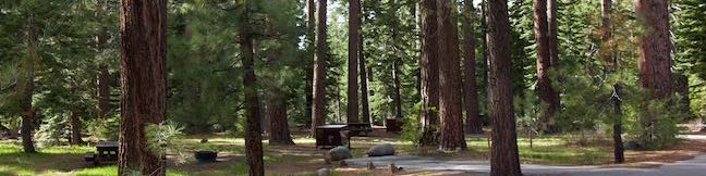
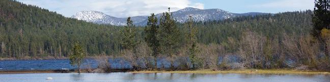
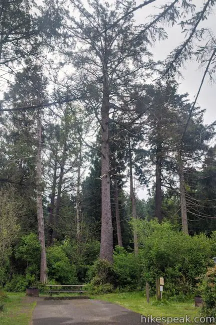
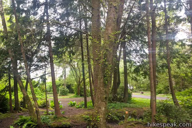
While Lake Tahoe’s deep blue waters are the region’s biggest draw for summertime visitors, the under-the-radar Fallen Leaf Lake is a jewel in its own right. Fallen Leaf Campground is a great basecamp for exploring both lakes, thanks to its central location about 1/4 mile from the north end of Fallen Leaf Lake and a mile from the south end of Lake Tahoe. Fallen Leaf Campground is spread through a forest of towering pines, providing access to a variety of recreational activities, both on and off the water.

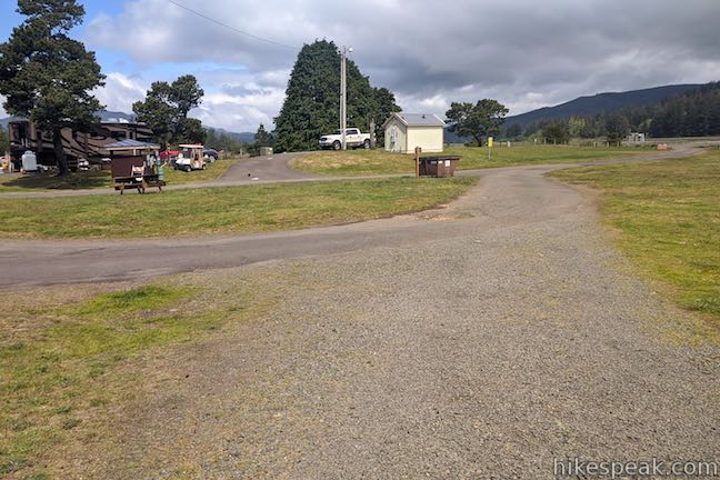
About the Campground
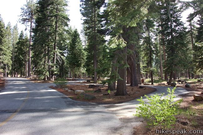
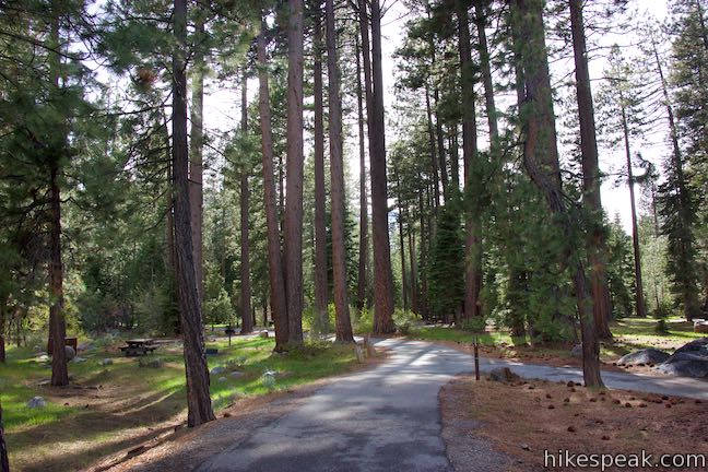
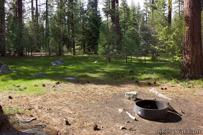
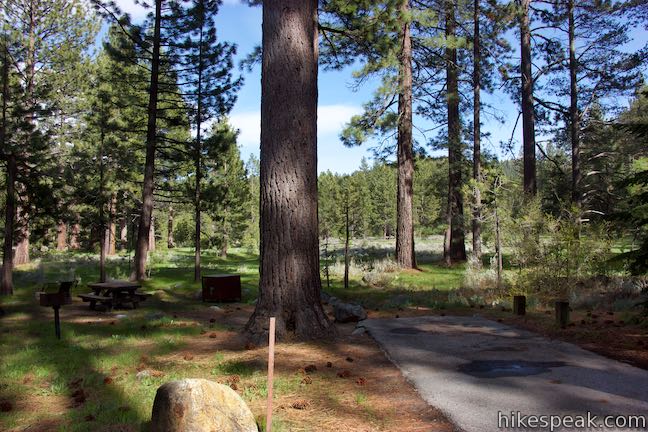
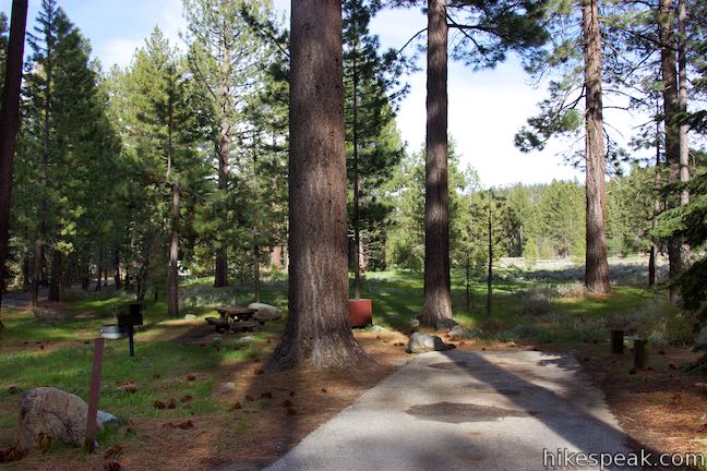
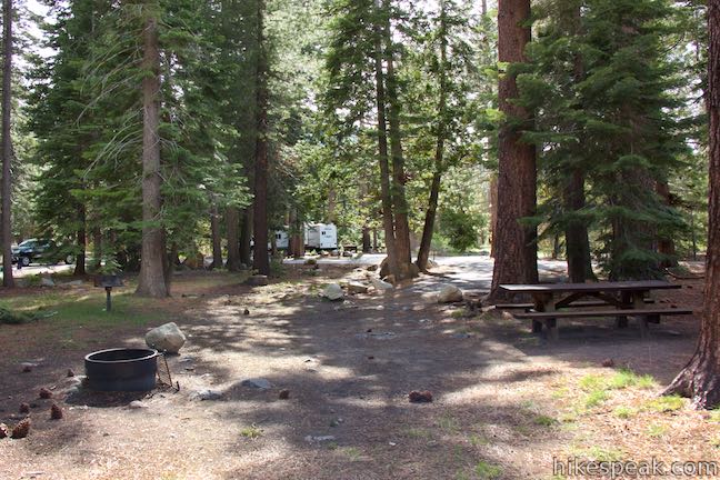
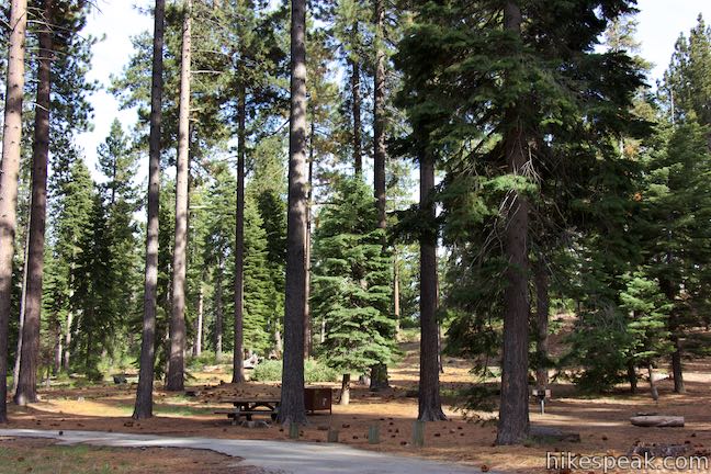
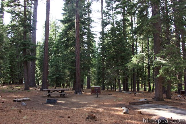
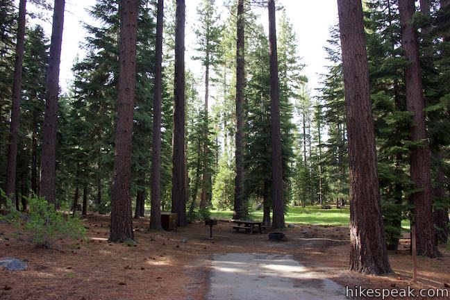
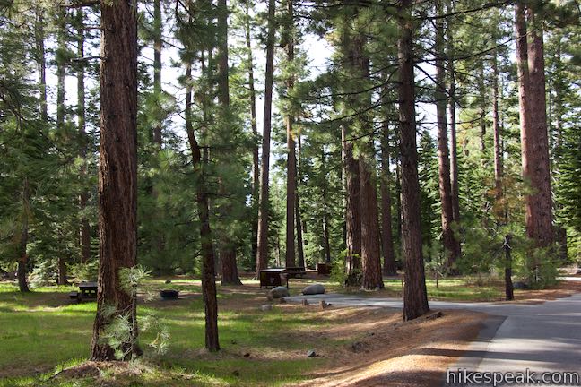
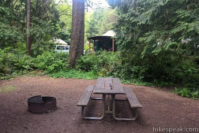
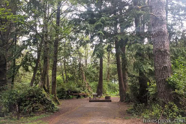
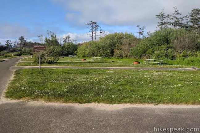
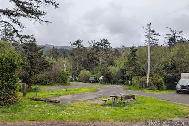
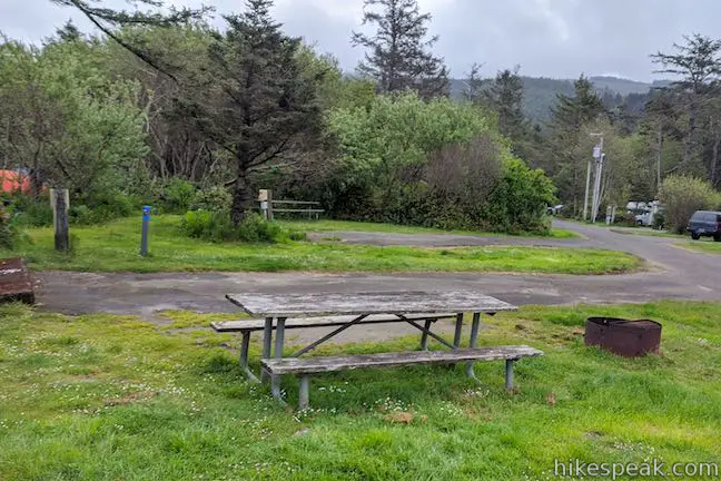
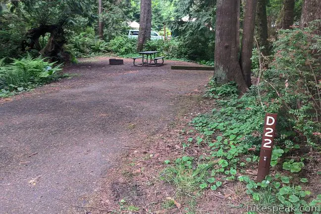
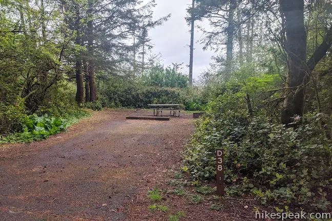
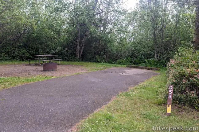
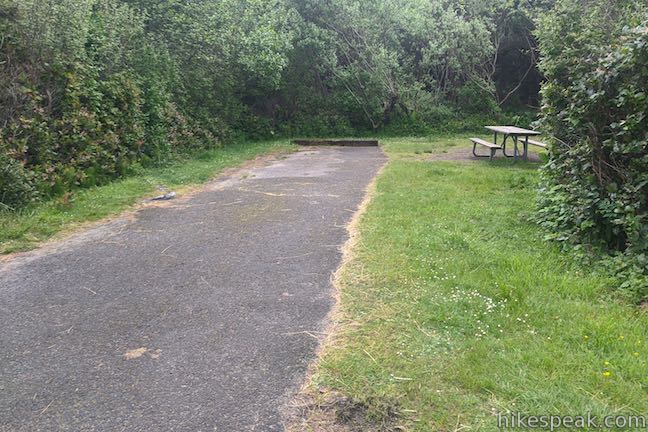
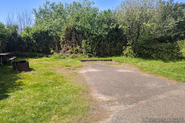
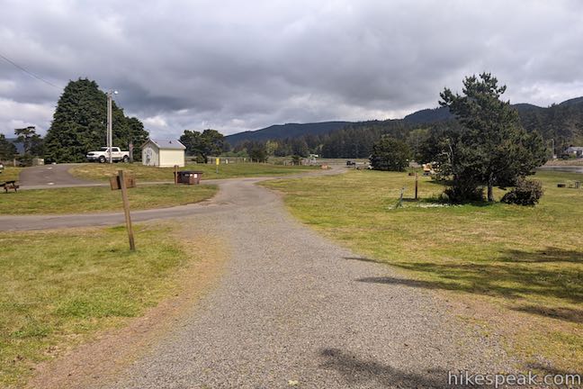
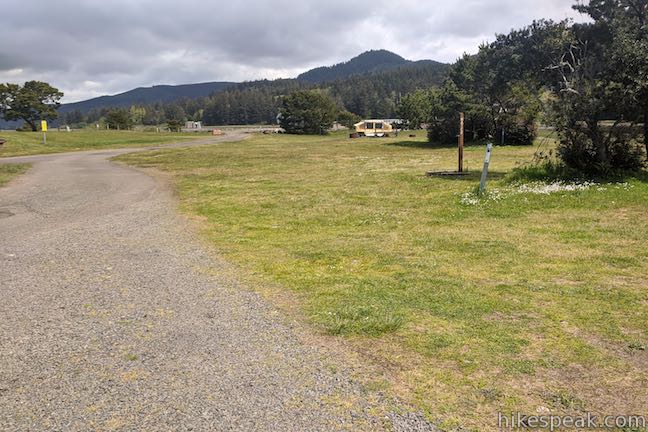
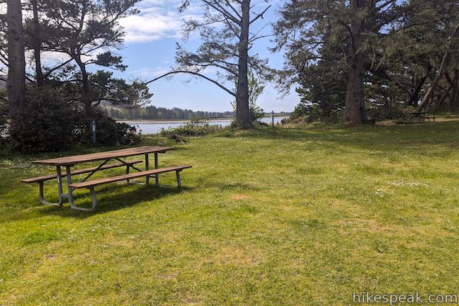
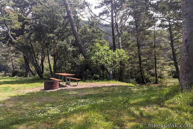
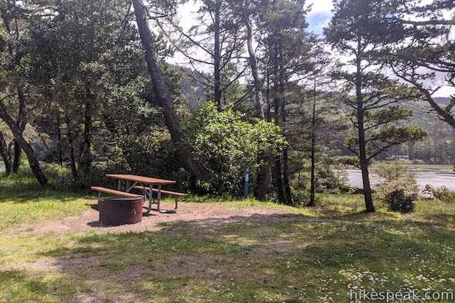
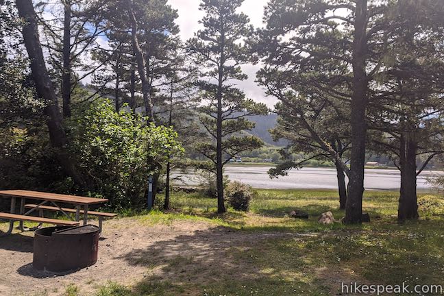
Fallen Leaf Campground is large, with 192 campsites spaced out along multiple loops. Each campsite is suitable for tents, RVs, and trailers (this count excludes several host campsites). All campsites are non-electric. Parking pads are long and paved. Some sites can accommodate RVs up to 40 feet long.
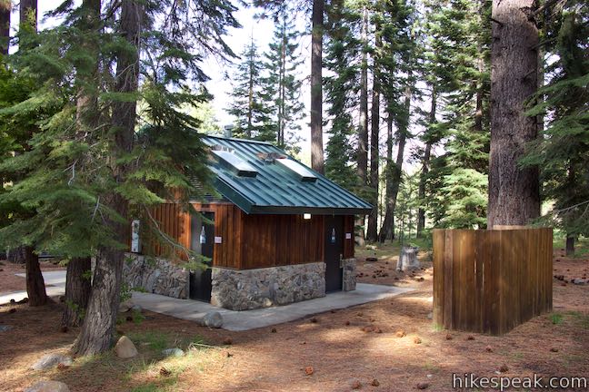
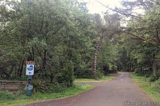
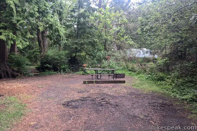
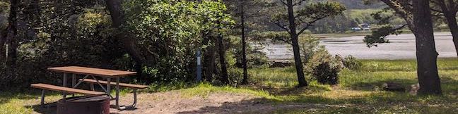
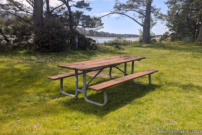
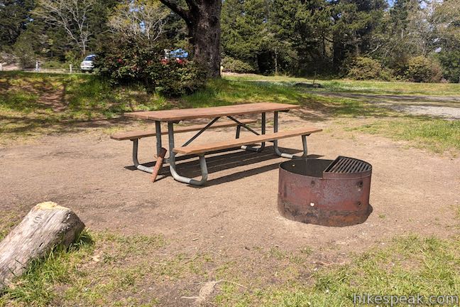
Campsites have picnic tables, fire rings, BBQ grills, food storage boxes (for bear safety), and access to potable water. Showers are available and firewood can be purchased on site. Fallen Leaf Store, located at the campground entrance, sells souvenirs and those common forgotten items that you need for camping, like ketchup and mustard.
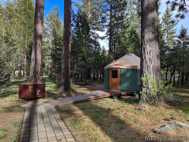
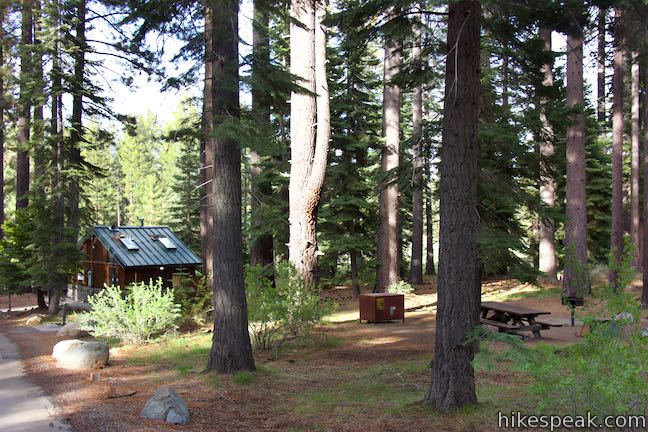
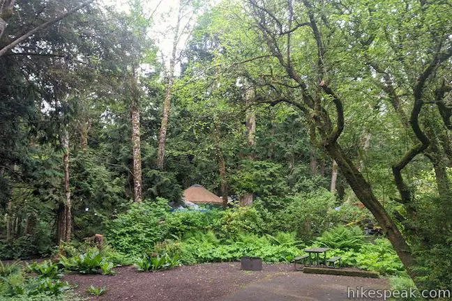
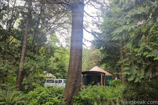
Additionally, Fallen Leaf Campground has 6 yurts that have a light and space heater, but no outlets for personal electronics.
Snow can cover the ground around Lake Tahoe until Memorial Day. This campground opens for the summer season from mid-May through mid-October and is closed the rest of the year. The tent/RV sites are $44 per night with $2 added to that price on holidays. The yurts are $118 per night with $2 added to that rate on holidays (all prices as of 2024). Campsites and yurts can be reserved in advance on recreation.gov.
About the Area
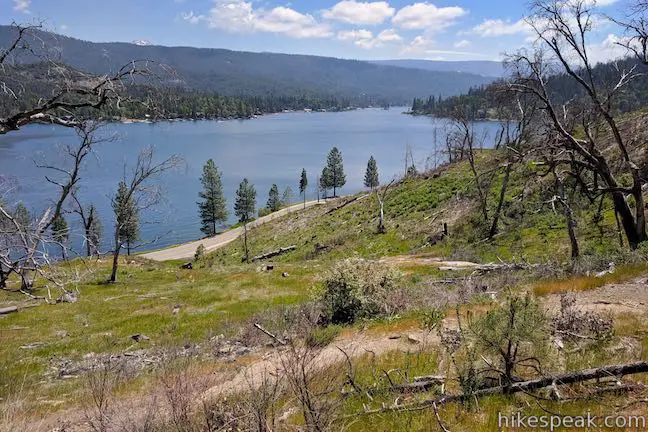
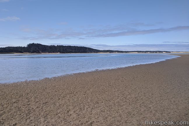
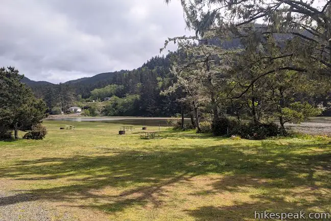
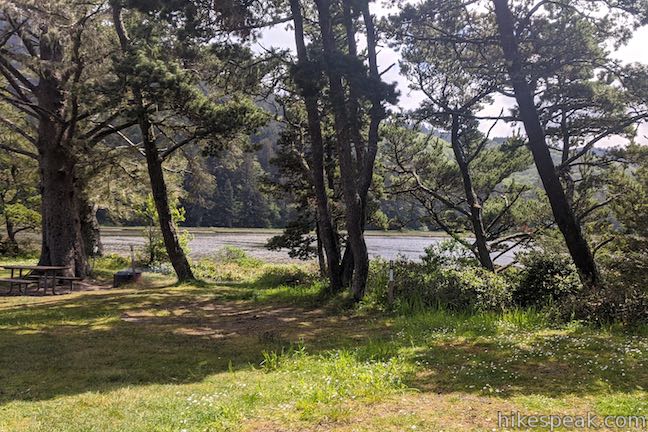
Fallen Leaf Lake is nearly 3 miles long and almost a mile wide (compared to Lake Tahoe itself, which is 22 miles long and 12 miles wide). Swimming is allowed in Fallen Leaf Lake, but there is not a designated swimming area or boat launch at the campground. For swimming in Lake Tahoe, both Pope Peach and Baldwin Beach are nearby.
The Taylor Creek Visitor Center, operated by the USDA Forest Service Lake Tahoe Basin Management Unit (just like Fallen Leaf Campground), is conveniently located across Highway 89 from the campground and has interpretive programs and self-guided nature trails.
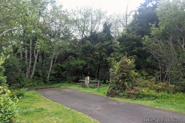
To get to Fallen Leaf Lake from the campground, and go for a pleasant hike, campers can explore the 1.1-mile long Moraine Trail, which leaves the campground near site 72.

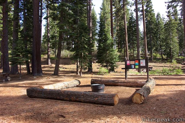
Be Bear Aware
At check-in, campers receive a leaflet warning that the campground is bear country. This is true for the Lake Tahoe region and is especially important at Fallen Leaf Campground because of the area’s topography. Fallen Leaf Campground sits in a narrow valley between Lake Tahoe and Fallen Leaf Lake. For animals like bears, the campground occupies the easiest pathway between the two lakes. Bear activity can occur in the campground at any time of day or night, either when bears are passing through or stopping to try to eat. Be mindful to follow the storage rules for food and trash.
- Store food, toiletries, coolers, grills, and other scented items in storage lockers
- Close and lock the storage lockers when not in use
- Keep trash in your storage locker or in the bear-resistant dumpsters
- Do not leave scented items in your tent or car
Bears can detect odors from long distances and are attracted to food and scented items that might smell like something to eat, such as toiletries and trash. Bears will travel to find the source of the smell, so be a responsible camper and follow proper food storage procedures to prevent:
- Interactions with bears
- Food conditioning of bears
- Potential human and bear injuries
If you encounter a bear in the campground the recommendation is not to approach, confront, or chase the bear. Back away slowly and keep yourself, your children, and pets a safe distance away. Report the bear sighting to the camp host. Because of the frequent bear activity, this campground attracts more people camping in RVs and trailers than people camping in tents.

To get to the campground: From the state line in South Lake Tahoe, take Lake Tahoe Boulevard (Highway 50) west for 5 miles to Tahoe Village and turn right onto Emerald Bay Road (Highway 89), heading northwest toward Tahoe City. Drive 3 miles (passing through Camp Richardson), and turn left onto Fallen Leaf Lake Road. Drive 2/3 of a mile to the entrance to Fallen Leaf Campground. Make two right turns to approach the campground entrance booth.
Campground address: Fallen Leaf Campground, 2165 Fallen Leaf Road, South Lake Tahoe, CA 96150
Campground coordinates: 38.9264, -120.04695 (38° 55’35″N 119° 120° 02’49″W)
Use the map below to create your own directions:

 |
Moraine Trail To Fallen Leaf Lake This 1.1-mile loop sets out from Fallen Leaf Campground in South Lake Tahoe to visit a forest creek and a gorgeous mountain lake. |
 |
Cave Rock Trail This 0.9-mile hike above the east shore of Lake Tahoe finishes with a scramble up a rocky crown that has panoramic views. |
 |
Chimney Beach Trail This 1.1-hike descends to a scenic and unique cove on the shore of Lake Tahoe that houses a stand-along chimney lingering from an old cabin. |
 |
Hikes in the Sierra Nevada Mountains Explore more trail in the range’s great national parks, national forests, and other park lands. |
Fallen Leaf Campground on recreation.gov
Fallen Leaf Campground on thedyrt.com
Fallen Leaf Campground on hipcamp.com
Fallen Leaf Campground on campsitephotos.com
Fallen Leaf Campground on campendium.com
Fallen Leaf Campground on camp-california.com
Fallen Leaf Campground on thisismyhappiness.com
Fallen Leaf Lake on visitlaketahoe.com
Fallen Leaf Lake on wikipedia.org
The official Forest Service webpage for Fallen Leaf Campground
The post Fallen Leaf Campground first appeared on hikespeak.com.


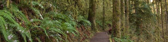
Moraine Trail to Fallen Leaf Lake in Lake Tahoe Basin National Forest Lands 26 Jul 2023 10:44 AM (last year)
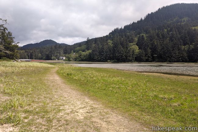
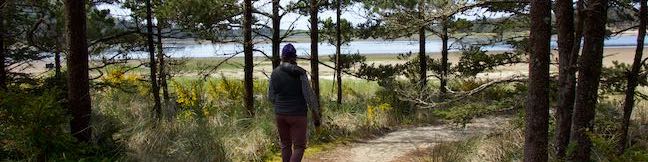
What’s better than hiking by a lovely creek – maybe hiking by a lovely lake. You can do both on Moraine Trail, visiting Fallen Leaf Lake and Taylor Creek in the Lake Tahoe Basin National Forest Lands near South Lake Tahoe. This easy and level loop is 1.1 miles long, including a short side trail to Fallen Leaf Lake Dam.
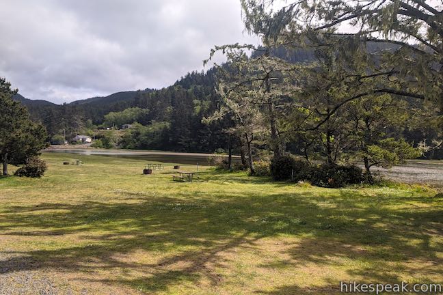
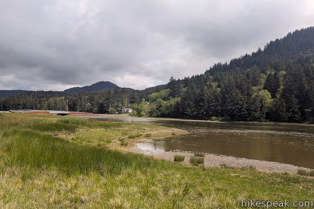
The mountain-cradled Fallen Leaf Lake is located just south of Lake Tahoe. The hike the the lake’s edge on Moraine Trail begins from a day use parking area within Fallen Leaf Campground, located by the north end of Fallen Leaf Lake.
The campground sits in a stretch of land, about 1 1/3 miles across, in between Lake Tahoe and Fallen Leaf Lake. That short distance is all that separates Fallen Leaf Lake from the much larger Lake Tahoe. Were it not for the glacier-created terminal moraine explored on this loop, Fallen Leaf Lake might have been a bay on Lake Tahoe.
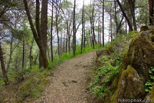
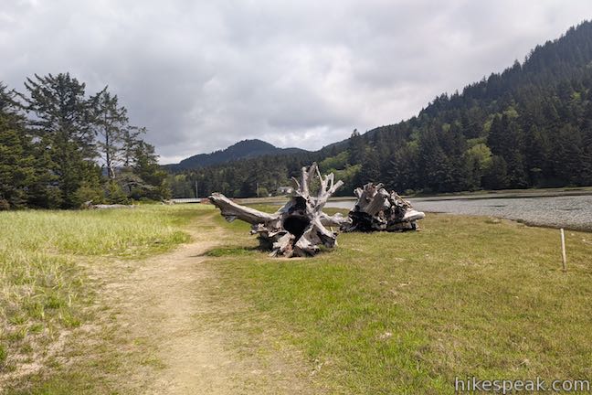
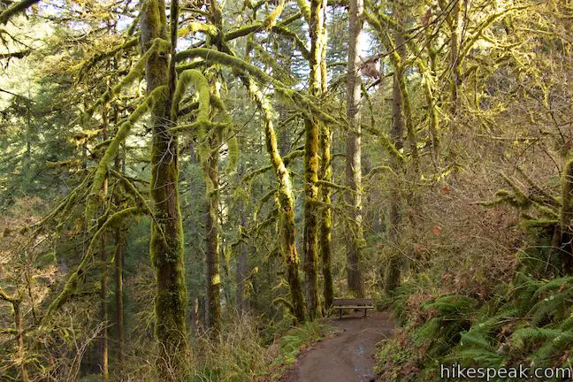
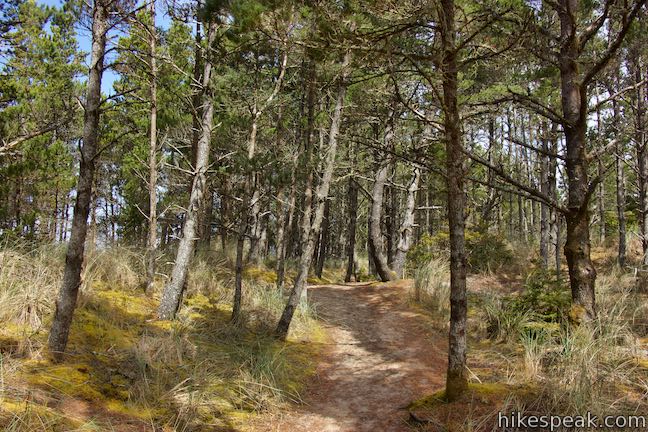
Moraine Trail sets out southward from the parking area. Walk into an airy pine forest, traveling along the right side of a bump in the terrain. After less than a hundred yards, come to a split in the trail. The loop begins here. A sign reading “Moraine Trail” has an arrow pointing to the right. The trail to the left goes straight to Fallen Leaf Lake and will be your return route. Follow the arrow and turn right on Moraine Trail toward Taylor Creek. In the late spring, red spikes of the fungi called snow plant appear on the forest floor. Bleeding hearts flower as the months turn to summer.

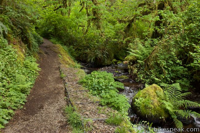
Walk along the trail as it finds the shoulder of Taylor Creek. A quarter-mile from the trailhead, come to a pair of benches on the bank above the creek. The benches are positioned in an L-shape, presenting a sweeping look over the water coursing through the forest.
Continue along the dirt single track, which provides a soft path padded by pine needles. In short order (and 1/3 of a mile from the start), the trail passes a burnt-out pine tree (and a tall one at that) on the right side of the trail, beside the bank of the creek. You can step right inside the black, hollow tree trunk.

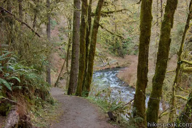
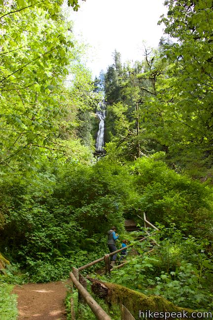
Proceed up the trail and approach a forest clearing that is home to a trail junction, half a mile from the start. To the left, Moraine Trail finds Fallen Leaf Lake for the loop back to the trailhead. To see the origin of Taylor Creek and get a nice look at Fallen Leaf Lake, turn right at the junction and make your way to the dam at the outflow of the lake.

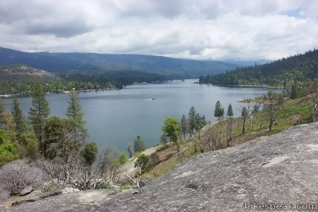
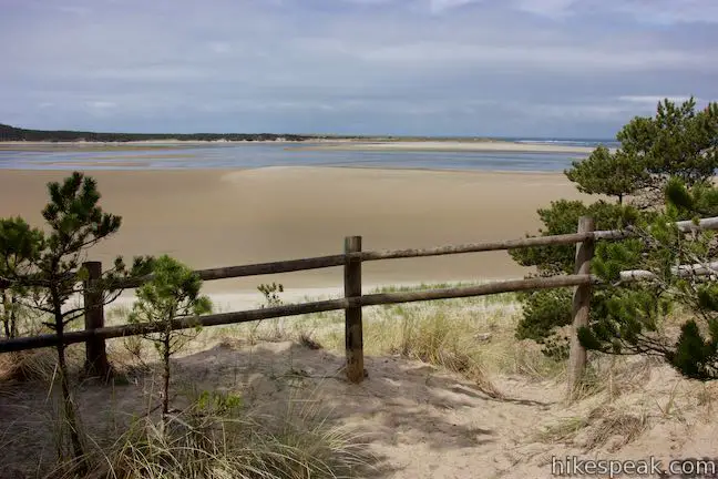
Walk about 50 yards over to the start of Fallen Leaf Lake Dam, which is itself about 50 yards long. The dam, which was built in 1934, has a wood plank walkway with chain-link fencing on both sides. Water spills from the north side, forming the start of Taylor Creek. Looking in the other direction, you will see a lot of blue water in Fallen Leaf Lake. Just to the south, a pine-covered point and a break wall separate the larger lake from the water flowing toward the dam. Look across the lake toward the evergreen ridge on the far side, which is backed by mountains that may be blanketed in snow.
Past the far end of the dam, the trail continues up to a T-junction. Unless you’re looking to explore more of the area, turn around when you get to the end of the dam. Backtrack to the junction in the clearing. The first half of Moraine Trail that bordered Taylor Creek is to the left. Go to the right to see the next half of Moraine Trail along Fallen Leaf Lake.
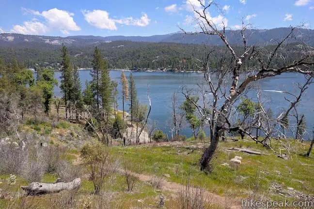
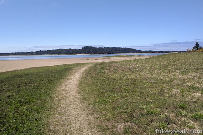
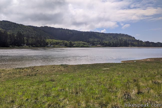
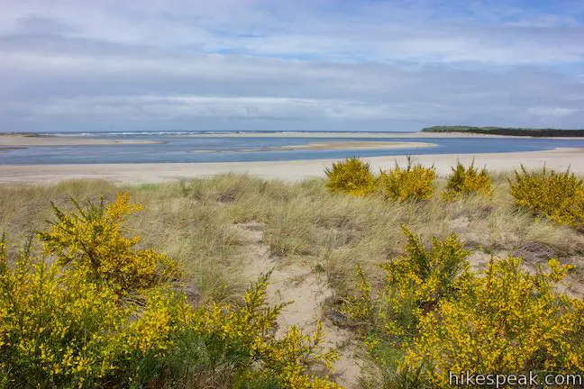
A thin row of trees and brush are all the separate the trail from the lake shore. A tenth of a mile past the junction, the trees open up to make a nice window looking out over the lake. In another twelfth of mile, the trail passes a bench by the water’s edge. Have a seat and look south down the lake. The blue water stretches for nearly 3 miles from end to end. The thumb-shaped lake is 0.9 miles across from east to west. At the far end, pine-filled slopes rise to Angora Peak, which is capped with a multi-point crown.

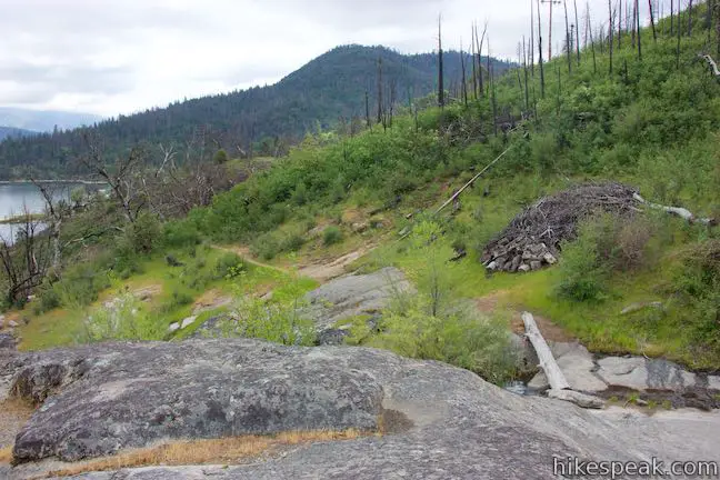
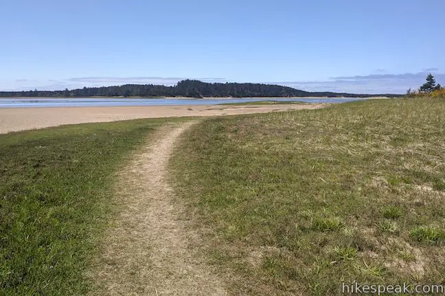
Continue hiking east along the trail and approach the very north end of the lake. Here you will find an unmarked junction, 0.95 miles from the start of the hike. Although there is a path continuing straight along the shore that might be scenic to explore, this is where the Moraine Trail leaves the water. To complete the short loop, turn left and leave the lake to return to the trailhead.

As you make your way through the last 0.15 miles of the hike, stop and look behind you. Admire this great perspective straight down Fallen Leaf Lake. Hike north over a short rise. The ever-so-subtle gain in elevation provides ample over-the-shoulder views toward the lake. The glaciers that carved Fallen Leaf Lake stopped right here, depositing the land between Fallen Leaf Lake and Lake Tahoe.
Make your way to the junction where the loop began. Turn right and hike the final 0.05 miles to complete this 1.1-mile outing with 35 feet of elevation change.
Guidelines: Moraine Trail is open to hikers, horses, and bikes. Dogs are welcome too. Motor vehicles and motorized equipment are forbidden. Overnight parking is not allowed at the day use parking area, so finish your hike by sundown. Trailers and long RVs are also not permitted in the day use parking lot. Picnic tables can be found alongside the day use parking. Fallen Leaf Campground is in active bear country (along with Moraine Trail). Avoid leaving scented items like food, trash, and toiletries in your vehicle. Place these items in bear storage lockers (or leave them at home).
Although you must drive through a fee station for Fallen Leaf Campground, no fee is charged to park at the day use area. The campground closes in the winter season (which is long in Lake Tahoe, running from mid-October to mid-May), making it impossible to drive to the day use parking area by the trailhead. During that period, park along Fallen Leaf Lake Road outside the campground and walk through the campground to the trailhead.
To get to the trailhead: From the state line in South Lake Tahoe, take Lake Tahoe Boulevard (Highway 50) west for 5 miles to Tahoe Village and turn right onto Emerald Bay Road (Highway 89), heading northwest toward Tahoe City. Drive 3 miles (passing through Camp Richardson), and turn left onto Fallen Leaf Lake Road. Drive 2/3 of a mile to the entrance to Fallen Leaf Campground. Make two right turns to approach the campground entrance booth. Drive through the campground for 2/3 of a mile on the campground road, going north, then west, then south to approach the day use parking area, which is on the right between campsite 72 and campsite 75.
Trailhead address: Fallen Leaf Campground, 2165 Fallen Leaf Road, South Lake Tahoe, CA 96150
Trailhead coordinates: 38.92348, -120.0547 (38° 55′ 24.5″N 120° 03′ 16.9″W)
The post Moraine Trail to Fallen Leaf Lake
in Lake Tahoe Basin National Forest Lands first appeared on hikespeak.com.

Way of the Mono Trail in Sierra National Forest 30 Jun 2021 11:32 AM (3 years ago)

Interpretive trails are usually good places to appreciate the finer features of a forest, but they tend to lack grand vistas. This is not the case with Way of the Mono Trail, which rises to a splendid view over Bass Lake, a beauty in the Sierra Nevada Mountains south of Yosemite National Park. Way of the Mono Trail is a 0.6-mile loop with 140 feet of elevation change. Panels along this single-track trail highlight several native trees and detail how the Mono, who were the first tribes to live in this place, made use of the different plants.
Things begin from the Way-Of-The-Mono Trailhead in Sierra National Forest, located on the east end of the south shore of Bass Lake. The trailhead has a parking area just off Road 222, directly across from the lakefront Little Denver Church Day Use Area (it is easy to visit park areas on the shore of Bass Lake in combination with Way of the Mono Trail).
The loop trail connects to both sides of the trailhead parking area. If you want to read the interpretive panels in order, hike the loop in a counter-clockwise direction. Begin from the right (northwest) side of the trailhead next to the bench and information board. In addition to providing a well-sequenced narrative, this direction saves the lake views for the descent.
Begin up the trail, stopping to read the first panel, which explains how the Mono people were a society of hunters and gatherers who lived in an area that extended from the east and west sides of the Southern Sierra:
They moved within their territory to follow animal migration and seasonal vegetable growth. The landscape traveled was environmentally dramatic, from sparse mountaintops to expansive lush valleys. As territory between tribes overlapped, around 1000 A.D., Mono bands settled on each side of the Sierra. …This valley, which is now flooded by Bass Lake, was home to many families.
The panels along the trail invite you to imagine what life was like for these first inhabitants. Learn how they made use of different forest resources. In an effort to relate to younger hikers, the panels tells the story of the Mono people from the perspective of a 10-year-old Mono girl who is preparing to celebrate a coming of age ceremony.
Continue up the trail to the next panel, which highlights the ponderosa pine. Beyond that, every so often, the trail passes another panel, focusing on white fir, poison oak, Manzanita, black oak, sugar pine, live oak, and soaproot. The panels for each plant explain how they were integrated into the lives of the Mono people. The Manzanita trees, for example, had berries that could be used to make juice.
Follow the trail up through a string of tight switchbacks. Allow the nicely moss-decorated boulders to distract you from the effort of the short ascent. Make your way up through the lovely forest of oaks and conifers, appreciating each panel along the way.
After 0.2 miles, Way of the Mono Trail leaves the forest for exposed slopes with few trees. In the spring and early summer, lupines bloom in the grasses beside your path. Hike up across a granite outcropping that is named (or at least nicknamed) Mono Rock. This is the high point of the loop at 3,530 feet.
Enjoy 180-degree views (or maybe closer to 270-degree views) over beautiful Bass Lake. Gaze southeast down Bass Lake Reservoir, where tapered evergreen-covered ridges frame its cool blue water. The far end of the lake looks gorgeous. Resorts and homes in the town of Bass Lake hug the shore on the opposite side of the lake. Forest-covered ridges rise above the lake. Snowy mountain crowns appear in the distance to the north.
This dome-shaped granite outcropping makes for a tranquil setting. From this height, the lake seems quiet and peaceful. Now for a mental challenge; can you imagine what Crane Valley looked like in the time of the Moro, before the lake was there? Bass Lake was created when the valley was dammed at the start of the 20th century. This hike’s interpretive panels explained how to the Mono made use of everything the forest had to provide. A panel describing the people who came after the Mono might say that they didn’t so much learn to live off what the land had to offer as the did change the land to suit their needs. The reservoir is beautiful, in any case.
If you can pull your eyes off the views all around you, you will notice bowl-shaped depressions in the granite underfoot. These grinding bowls, called morteros (or mortars) were used by Native Americans to grind nuts and seeds into meal. An information panel explains how the grinding holes were important tools:
Acorns are placed in depressions made from many hours of pounding and grinding with a large rock. The large rounded rocks are smoothed by the environment in nearby creeks. The acorn flour is washed on grass mats through White Fir or Cedar boughs, then put in water tight baskets. Water is added to the flour and hot rocks are placed in the basket to cook acorn meal.
This is the final panel along Way of the Mono Trail, located at its high point, halfway through the loop (0.3 miles from the start). The second half of the loop lacks reading material, but makes up for it with lovely lake views and a couple fun stream crossings.
The trail isn’t super defined as you go across the granite dome, but just keep moving in the same southward direction. Below the dome, the trail will be visible where it leaves the granite and becomes a more distinguished single-track again. Behind the trail to the south, past a ridge or two, Goat Mountain rises to a nice evergreen crown.
Step down the south side of the granite, dropping off the side of the rock toward a small creek. You can probably just hop across, or there should be a log to use for the crossing. It is unlikely that there will be too much water.
Pick up the dirt single track crossing through brush and hike out to a switchback. The trail turns left and makes its way across the slope below the granite dome at the top of the loop. The mountainside has a scattering of old fire-charred trees, but the vegetation is mostly open to lots of lake views. The exposed east-facing slope is also home to a bouquet of summer wildflowers like irises, yellow stars, checkerbloom, and a couple lovely varieties of lupines.
Pass underneath the granite dome (remember standing on top of the loop’s high viewpoint). The creek that you crossed above slips out through a jumbled pile of boulders that resemble a talus cave. Hop across the little creek and watch the water spill down a granite slide. After very heavy rains, the diminutive creek could swell to something showy through these granite features.
The fun stream crossing is 0.45 miles from the start of the hike. This is also a good spot to look down on Road 222 as it hugs the shore of Bass Lake. Take in one last view over the lake before the trail enters the forest again. While not as dense as the woods at the start of the loop, you can enjoy a bit of shade over the final stretch of the trail as it makes its way back down to the trailhead to close the loop.

Way of the Mono Trail offers history, nature, spring wildflowers, and stellar views of Bass Lake. Given the easy commitment of just 0.6 miles with 140 feet of elevation change, Way of the Mono Trail would be worth hiking for the views alone! Way of the Mono Trail is closed to motor vehicles, horses, and pack stock, but you can bring a dog. Bikes appear to be allowed as well (although this probably isn’t the most appropriate trail for bikes). If you would like to stay longer in the area, lakefront campgrounds and picnic areas are just across the road from trailhead.
To get to the trailhead: Take Highway 41 to Yosemite Forks, which is located 3.4 miles north of the main intersection in Oakhurst and 12.3 miles from the south entrance of Yosemite National Park by Mariposa Grove. Leave Highway 41 in Yosemite Forks and head east on Road 222, following signs for Bass Lake. This will be a right turn if you are driving up from Oakhurst.
Drive 3.5 miles on Road 222 to an important intersection. Straight ahead, Road 222 turns into Road 274 and goes along the north shore of Bass Lake. Don’t go straight. Turn right to remain on Road 222. Drive 1/3 of a mile to the first major intersection after a couple roads on the right into a development of cabins. Turn right again, following a sign for “Bass Lake Ranger Station Camping and Day Use Information.” You will still on Road 222 (now also called South Shore Road), despite the two right turns. Drive 1 mile to the trailhead parking area on the right, which is half a mile after the Bass Lake Recreation Office for Sierra National Forest (also on the right). Pull into the lot with the sign for Way-of-the-Mono Trailhead, located across Road 222 from Little Denver Church Day Use Area.
Trailhead address: Way-of-the-Mono Trailhead, Road 222, Bass Lake, CA 93604
Trailhead coordinates: 37.3219, -119.5781 (37° 19′ 18.8″N 119° 34′ 41.2″W)
The post Way of the Mono Trail
in Sierra National Forest first appeared on hikespeak.com.

Cape Lookout State Park Campground 28 Jun 2021 1:11 PM (3 years ago)
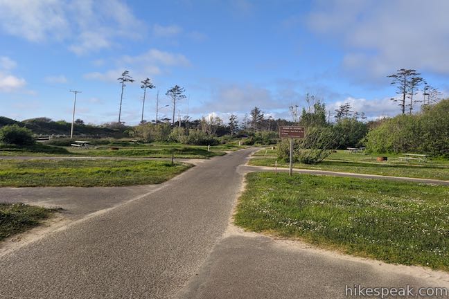
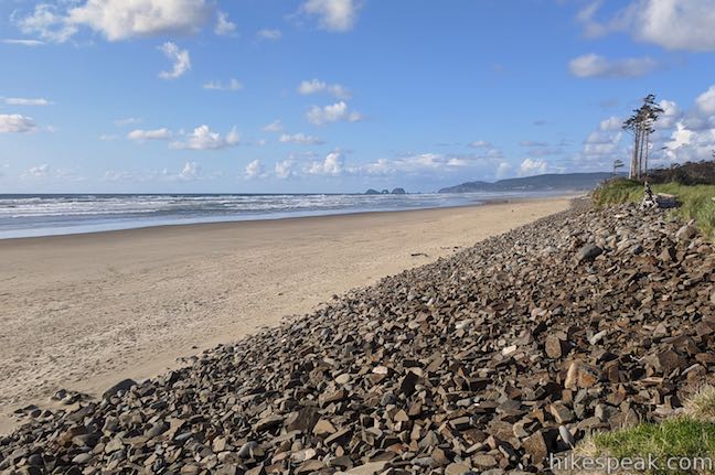
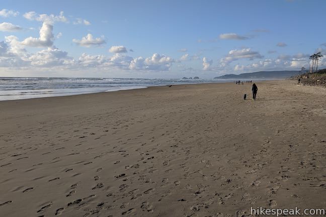
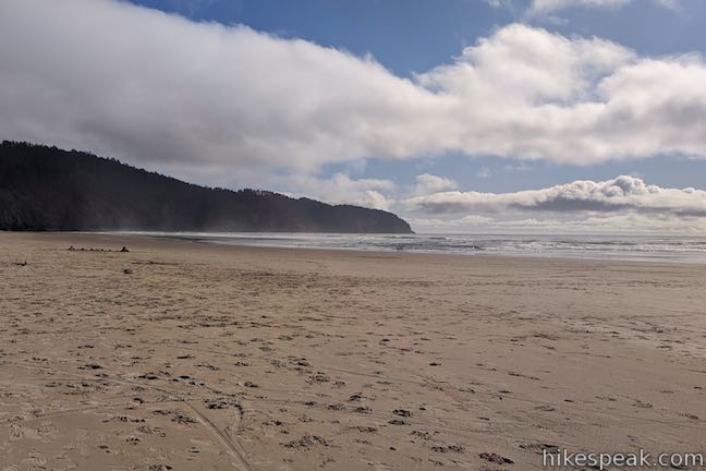
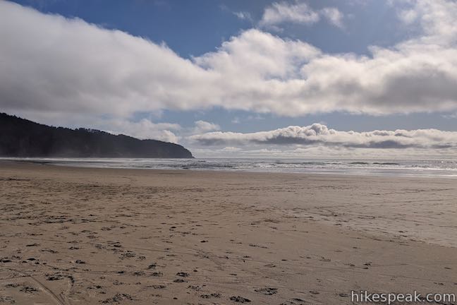
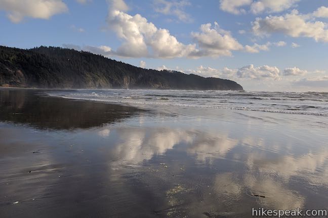
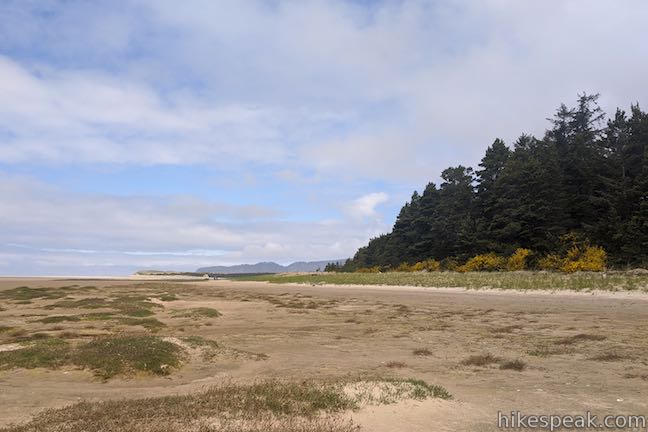
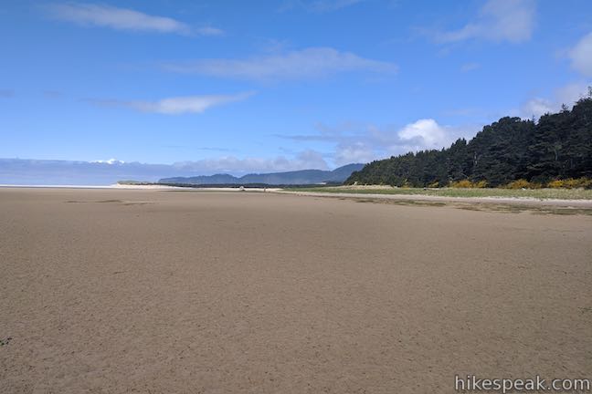
Jutting out from the coast of Oregon west of Portland, Cape Lookout is a prominent promontory with tall cliffs towering hundreds of feet above the Pacific Ocean. The campground in Cape Lookout State Park is not as soaring. Luckily for beach-lovers, the campground is tucked right behind a big, beautiful beach on the north side of the cape.
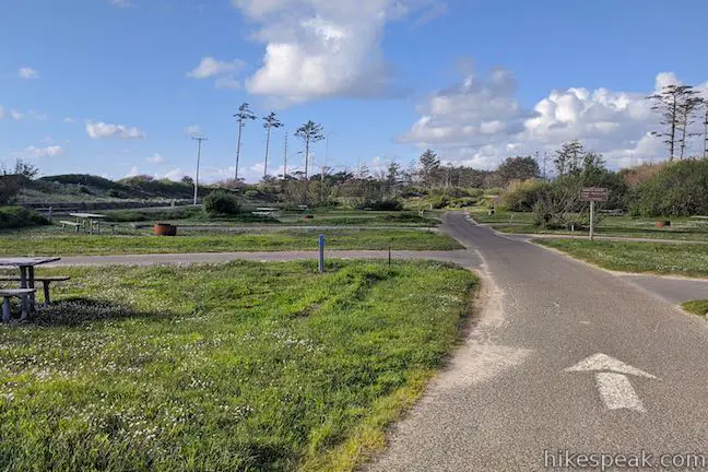
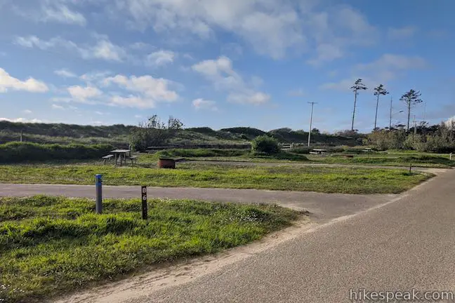
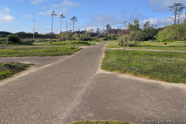
Cape Lookout State Park Campground is a major destination, with over 200 campsites. The campsites are spread out on a few loops, labeled A, B, C, and D.
The A & B sites are closest to the ocean, with 75 tent sites up for grabs, plus one site with an electric hookup. These campsites fill grassy plots behind the beach and are exposed to the sun and wind, as well as the eyes of neighboring campers. These sites offer a low amount of privacy.
The C & D sites are set back just a bit farther from the coast and are sheltered by vegetation. The sites along these loops offer much greater privacy between campsites. Bushes like salal border the campsites like natural dividers. Western red cedar and Sitka spruce provide lots of shade, especially for the campsites farthest from the coast.
On the C & D loops, 32 sites have full hookups for RVs and camp trailers, with driveways ranging from 37 to 60 feet long. Another 93 additional sites cater to tent campers and do not have water and electrical hookups. The C loop also has 13 yurts, for sheltered camping that you don’t have to setup and take down yourself. For those in wheelchairs, two of the yurts and two of the RV sites on the C loop are designed to offer more accessibility.
Additionally, Cape Lookout State Park has 6 deluxe cabins and a couple group tent camping areas. As far as the number of guests goes, the cabins are for up to 5 people. The yurts sleep 8. The tent sites and the full hookup sites are for up to 8 people. The group sites can hold up to 25 people in tents.
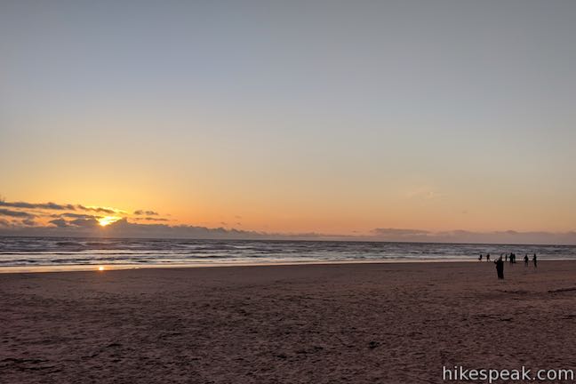
Obviously, if you’re camping at Cape Lookout State Park, you’re interested in more than just the campsites. You also want to know about the beach. It’s just over that rise!
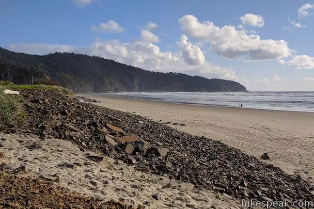
A man-made dune-like barrier separates the campground from the beach. Take one of the cobblestone paths over this revetment to reach the expansive beach. This protective berm is tall enough that you can’t see the ocean from the campsites themselves. You can hear the ocean from the campground though, and the beach is just a short walk from any campsite.
The beach in front of the campground is big, open, and beautiful. To your left, Cape Lookout extends into the ocean like a large evergreen-covered finger. In front of the cape, you are likely to see something colorful in the sky. Hang gliders and paragliders jump from Gammon Launch (a turnout along Cape Lookout Road) and circle through the air before landing on the beach south of the campground.
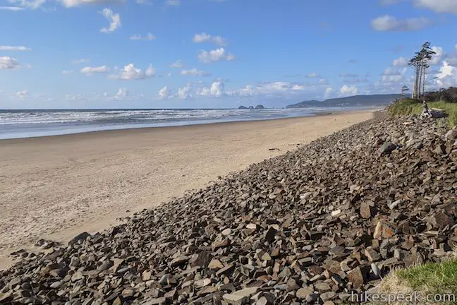
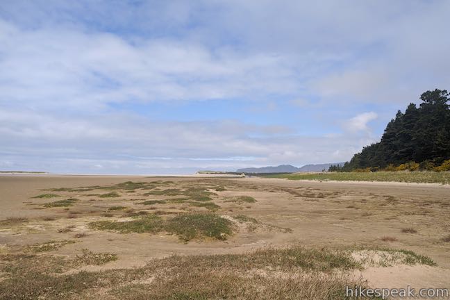
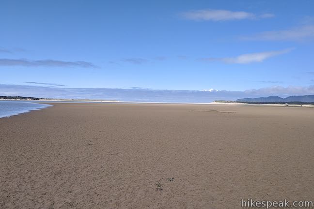
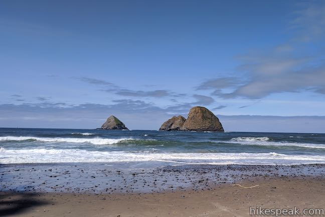
To the north, the beach just keeps going and going. If you want, you could walk for miles up the beach on the side of Netarts Spit, which shelters Netarts Bay to the north. Standing out of the water to the north are the Three Arch Rocks. Located off the coast near Oceanside, these rock islands will definitely draw your eye.
Whether you’re going for a peaceful stroll, playing in the sand, or watching the sunset over the ocean, the beach by Cape Lookout State Park Campground offers everything that you are looking for.
- Beyond the beach, Cape Lookout Trail is a great place to spend the day.
Cape Lookout State Park has 218 campsites available:
- 168 tent sites
- 33 RV-friendly sites (32 with full hookup, 1 with electric hookup only)
- 13 yurts
- Additionally, there are 2 group tent sites and 6 deluxe cabins
The cost of each site depends on the amenities. Standard tent sites are $21 per night. The full hookup sites for RVs and trailers are $33-$37 per night. Yurts can be reserved for $47 – $62 per night. The cabins are $96 to $106 per night and the group tent sites are $78 per night. A $8 reservation fee is charged for any online reservation. Each site can have a max of two vehicles. One vehicle is included with each reservation and there is a $7 fee for extra vehicles. Firewood is available from the hosts for $10 per bundle. (All prices as of 2021.)
All sites can be reserved. Yurts and cabins must be reserved in advance. Any available (not reserved) campsites that are vacant can be booked in person for one night. If you arrive at the campground without a reservation and are looking to stay the night, you might get lucky. However, this campground is likely to be full most summer weekend. If you’re trying to make a last minute reservation, check nearby Whalen Island County Campground if Cape Lookout State Park is full. To make a reservation, visit oregonstateparks.reserveamerica.com or call (503) 842-4981.
The campground bathrooms have flush toilets and push button showers (coins aren’t needed to operate the showers, but there is also no temperature control and the water comes out in short, hot bursts). Potable water spigots are located around the campground, as well as at sites with the full water and electrical hookups. Each campsite has a picnic table and a tall fire ring.
Dogs (and other pets) are expected to be on leashes while in the campground and park (unless they are inside a vehicle, tent, or RV). Fires are allowed in designated fire rings and camp stoves. Don’t plan on gathering firewood.
The campground’s check-in time is on the late side at 4 p.m. Check-out time is by 1 p.m., so you don’t need to rush out of the campground the day you’re leaving and should have time for a parting morning stroll on the beach.
A self-guided nature trail is located near the campground. Relax on the beach, hike Cape Lookout Trail, and explore surrounding places on the Oregon Coast. Cape Lookout State Park is an excellent place to camp!
To get to the campground: From the intersection of Highway 101 and Route 6 in Tillamook, head west on Netarts Highway (Route 131), which is straight across Highway 101 from Route 6 for those traveling from Portland. Take Route 131 southwest for 5 miles and bear left on Whiskey Creek Road, following signs for Cape Lookout State Park. Drive 5.2 miles and turn right into the state park entrance. Drive 1/3 of a mile and turn right toward the entry booth into the campground. To get to Cape Lookout Trail from the campground, drive out to the park entrance and turn right onto Cape Lookout Road. Drive 2.7 miles up Cape Lookout Road to the trailhead parking area on the right.
Campground address: Whiskey Creek Road & Cape Lookout Road, Tillamook, OR 97141
Campground coordinates: 45.3627, -123.9689 (45° 21′ 45.7″N 123° 58′ 08″W)
Use the map below to view the campground and get directions:


 |
Cape Lookout Trail This 5-mile round trip hike ventures down a promontory on the Oregon Coast with beautiful ocean views. |
 |
Whalen Island Loop Trail This 1.5-mile hike explores a lovely island-like park in Sand Lake Estuary with ocean and wetland views. |
 |
Oceanside Beach to Tunnel Beach This 0.8-mile beach walk comes with an adventurous twist, a man-made tunnel through a cliff that leads from one beautiful beach to another more secluded beach in Oceanside. |
 |
Cape Meares Lighthouse & Octopus Tree This easy 0.8-mile hike in Cape Meares State Park visits a beautiful lighthouse and an equally impressive tree, exploring a coastal cape with tall cliffs and big ocean views. |
 |
Cape Kiwanda This short beach hike explores tide pools and sand dunes at a rugged headland on Oregon’s coast near Pacific City. |
 |
Munson Creek Falls Trail This short hike near Tillamook travels up a forest canyon to the tallest waterfall in Coastal Oregon. |
 |
Alder Island Nature Trail This short, easy hike off the coast south of Lincoln City explores a small island at the mouth of the Siletz River. |
 |
Ecola Point to Indian Beach This 2 2/3-mile round trip hike explores a wild and beautiful section of Oregon Coast Trail between Ecola Point and Indian Beach in Ecola State Park. |
 |
Saddle Mountain Trail This 5-mile round trip hike rises through fir forests and wildflower-filled slopes up to a summit with panoramic coastal views. |
 |
Beaver Falls This short hike slips down through forest to a beautiful waterfall plunging over a basalt wall. |
 |
Trails in Oregon Explore more hikes throughout the state of Oregon. |
 |
Whalen Island County Campground This 33-site campground is a nice camping option on Whalen Island with easy access to estuary beaches and a loop hike. |
The post Cape Lookout State Park Campground first appeared on hikespeak.com.

Whalen Island County Campground 22 Jun 2021 4:33 AM (3 years ago)
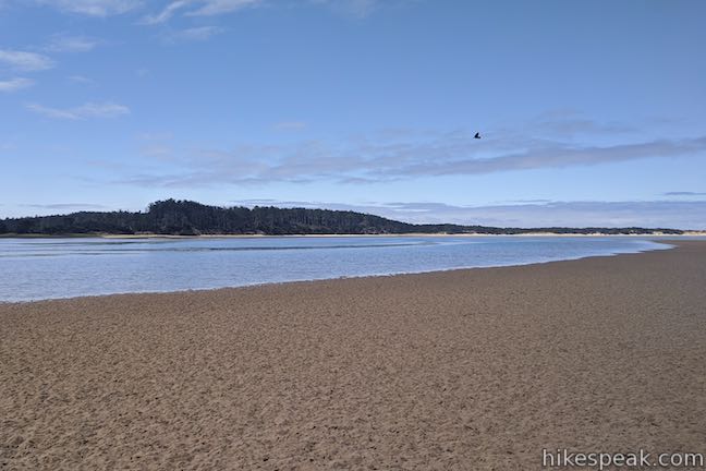
Camping by the ocean should be easy and relaxing – Fun in the sun and toes in the sand. That’s what you can expect to find at Whalen Island County Campground in Tillamook County. This 33-site campground sits inside the Sand Lake Estuary, a special spot along the Three Capes Scenic Loop between Cape Kiwanda and Cape Lookout on the Oregon Coast.
Right from the campground, it is easy to go kayaking, paddleboarding, bird watching, fishing, clamming or hiking. You can walk from the campground straight onto Whalen Island Loop Trail and there are plenty of nearby places in Coastal Oregon to hike and explore.
Located in the middle of an an estuary, Whalen Island isn’t too far from being an island right in the Pacific Ocean. Instead, Whalen Island is just behind the actual ocean coast. Also, full disclosure, Whalen Island isn’t technically an official island since it is bordered by estuary wetlands on one side and only becomes convincingly surrounded by water during seasonal high tides. Whalen Island County Campground is about 3/4 of a mile inland from where the waves meet the beach. It’s not on the ocean, but it is ocean-y.
Whalen Island County Campground has 33 campsites spread out around a few paved and gravel loop roads. The campground occupies a grassy area at the southeast end of Whalen Island. Shore pines along two sides of the campground provide shade and protection from the ocean winds.
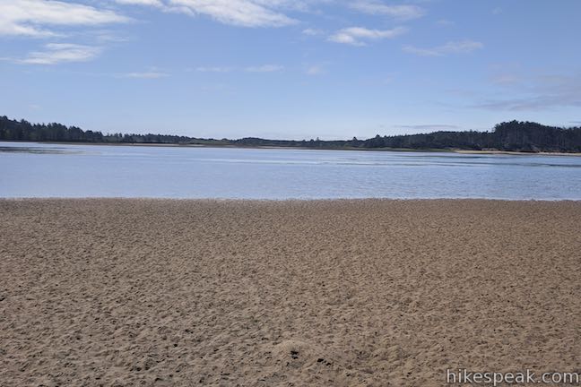
A day use area and boat launch next to the campground provides access to the Sand Lake Estuary. The tidal waters are only a few feet deep, so they are too shallow for motorboats, but work well for kayaking or stand-up paddleboarding.
A path from the campground goes west to a beach area that has nice views across the estuary toward Sitka Sedge State Natural Area. The beach has plenty of nice sand. Depending on the level of the tide, a sizable mud flat stretches out between the sand and the water. A path along the beach goes north up the west side of Whalen Island, approaching greater views out the mouth of the estuary, where ocean waves can be seen coming in toward the beaches.
At the back of the campground, near site 6, there is a path connecting to Whalen Island Loop Trail, a scenic and relatively easy 1.5-mile hiking trail around the perimeter of Whalen Island.
Whalen Island County Campground has 33 numbered sites that can be reserved in advance. Unlike many of Oregon’s popular state park campgrounds on the coast, you may not need to book too far in advance to find a weekend campsite at Whalen Island.
During the winter season, fewer sites may be open for camping. Campsite prices are also lower in the winter. The summer season runs from May through September. The campsites are color coded with blue sites and brown sites on the campground map. The blue sites are roomier and cost a bit more.
The brown campsites have an area for one 10-foot by 10-foot tent and space for one or two vehicles (extra charge for a second vehicle). These sites allow up to 6 people in one party.
The blue campsites have areas for two 10-foot by 10-foot tents. These sites allow up to 10 people in one party. These sites also have parking for two vehicles (extra charge for a second vehicle or a second tent). RVs are allowed to park at blue sites, as long as they fit in the campsite driveway. Dry camping only.
The campground pricing structure is a bit intricate. Each campsite reservation comes with an $11 registration fee. This works out to a higher price for the first night of camping and a lower price for subsequent nights. The summer rates are:
- Blue sites: $38 for the first night and $27 for each additional night ($22 per night in the winter)
- Brown sites: $33 for first night and $22 for each additional night ($16 per night in the winter)
- Hiker-Biker: $20 for one person for the first night and $9 for additional nights. If more than one person are sharing a site, it is $9 per person per night.
Setting up a second tent? That will be $8 per night per tent (RVs are counted as tents). Bringing a second vehicle? Extra vehicles, boats, or utility trailers are $6 per night per vehicle. Are you bringing a dog? There is a $6 fee for each pet per stay.
If you are coming to Whalen Island County Park, but don’t intend to camp, the day use area by the boat launch charges a $10 fee per vehicle (all prices as of 2021). Most of Whalen Island is actually preserved by Clay Myers State Natural Area, which has a parking area near the campground that does not charge a fee.
Guests should check in with the camp host before settling in. Pets are expected to be on leash at all times. Check-in begins at 3:30 p.m. Early check-ins are not allowed. Campers must check out by 1:30 p.m. The campground has a dump station, a bathroom, and spigots for drinking water. Each campsite has a picnic table and a fire ring. The walk-in hiker-biker area is for those who arrive at the campground by “people-powered travel.” Although it is permitted to collect small pieces of wood, it is best to bring your own firewood.
Campsites may be reserved in advance by calling (503) 322-3522 or online at reservations.co.tillamook.or.us. Visit Tillamook County’s webpage for Whalen Island County Campground for more information or send questions to parks@co.tillamook.or.us.
- For additional nearby camping, check out Cape Lookout State Park Campground.
To get to the campground: From the center of Tillamook, where US 101 intersects Route 6 (to Portland) and Route 131 (to Oceanside and Cape Meares), travel south on Highway 101. Take US 101 for 11 miles to a major intersection (4 miles past the road to Munson Creek Falls). Turn right onto Sandlake Road and drive west for 4.3 miles. At an intersection with Cape Lookout Road, turn left to stay on Sandlake Road, following signs for Pacific City. (If you are taking the coastal route south down Cape Lookout Road, the Sandlake Road intersection is just 3.3 miles past the Cape Lookout Trailhead.) From the intersection, drive south for 3.6 miles on Sandlake Road and then turn right onto Whalen Island Road. Drive down across a bridge. Pass the day use parking area on the left and then turn left into Whalen Island County Campground (Clay Myers State Natural Site is located at the end of the road).
Campground address: Whalen Island Road, 25210 Sandlake Road, Cloverdale, OR 97112
Campground coordinates: 45.2729, -123.9496 (45° 16′ 22.4″N 123° 56′ 58.6″W)
Use the map below to view the campground and get directions:


|
Whalen Island Loop Trail This 1.5-mile hike explores a lovely island-like park in Sand Lake Estuary with ocean and wetland views. |
|
Munson Creek Falls Trail This short hike near Tillamook travels up a forest canyon to the tallest waterfall in Coastal Oregon. |
|
Oceanside Beach to Tunnel Beach This 0.8-mile beach walk comes with an adventurous twist, a man-made tunnel through a cliff that leads from one beautiful beach to another more secluded beach in Oceanside. |
|
Cape Meares Lighthouse & Octopus Tree This easy 0.8-mile hike in Cape Meares State Park visits a beautiful lighthouse and an equally impressive tree, exploring a coastal cape with tall cliffs and big ocean views. |
|
Cape Lookout Trail This 5-mile round trip hike ventures down a promontory on the Oregon Coast with beautiful ocean views. |
|
Cape Kiwanda This short beach hike explores tide pools and sand dunes at a rugged headland on Oregon’s coast near Pacific City. |
|
Alder Island Nature Trail This short, easy hike off the coast south of Lincoln City explores a small island at the mouth of the Siletz River. |
|
Ecola Point to Indian Beach This 2 2/3-mile round trip hike explores a wild and beautiful section of Oregon Coast Trail between Ecola Point and Indian Beach in Ecola State Park. |
|
Saddle Mountain Trail This 5-mile round trip hike rises through fir forests and wildflower-filled slopes up to a summit with panoramic coastal views. |
|
Beaver Falls This short hike slips down through forest to a beautiful waterfall plunging over a basalt wall. |
|
Trails in Oregon Explore more hikes throughout the state of Oregon. |
 |
Cape Lookout State Park Campground This grand, oceanfront campground has over 200 sites right behind a big, beautiful beach. |
The post Whalen Island County Campground first appeared on hikespeak.com.

Maple Ridge Loop in Silver Falls State Park 14 Jun 2021 8:13 AM (3 years ago)
Maple Ridge Loop travels behind two breathtaking waterfalls and goes through miles of wonderful forest in Silver Falls State Park. This 2.8-mile loop (with 375 feet of elevation change) is a combination of two trails, Canyon Trail and Maple Ridge Trail. Canyon Trail goes down the trough carved by South Fork Silver Creek, taking hikers amazingly close to South Falls and Lower South Falls. Maple Ridge Trail travels beside the canyon on its wooded rim. Silver Falls State Park has waterfall hikes of several lengths. When the Trail of Ten Falls Loop (7.9 miles) seems too long, but the South Falls Loop (1.1 miles) isn’t quite enough, Maple Ridge Loop makes an excellent middle option.
Note: The park guide proposes hiking Maple Ridge Loop in a clockwise direction, hiking down Canyon Trail and returning to the South Falls Day Use Area via Maple Ridge Trail. The loop can certainly be hiked this way (and going to the waterfalls first can be hard to resist). However, the instructions provided here take the loop in the opposite direction, following Maple Ridge Trail down into the canyon and then hiking up Canyon Trail to Lower South Falls and the even more impressive South Falls. Two reasons for this sequence are:
- Positioning the waterfalls to be seen head-on as you hike up Canyon Trail (requiring fewer over-the-shoulder glances toward the waterfalls).
- Placing the big switchbacks at the bottom of Maple Ridge Trail as a downhill experience instead of a climb.
The basic directions for Maple Ridge Loop are:
- Leave South Falls Trailhead (0 miles)
- Hike past South Falls Lodge to the Stone Circle Junction and turn left on Canyon Trail – alternatively continue straight through the South Falls Historical District (0.15 miles)
- Come to a junction with Maple Ridge Trail and turn right on Maple Ridge Trail, leaving Canyon Trail (0.2 miles)
- Pass the trail through South Falls Historical District, joining Maple Ridge Trail on the right (0.33 miles)
- Stay to the left as Maple Ridge Trail passes a fire road and turns downhill (0.75 miles)
- Pass the first of three bench-bearing switchbacks on the descent to Canyon Trail (0.95 miles)
- Turn left on Canyon Trail at the bottom of Maple Ridge Trail (1.3 miles)
- Follow Canyon Trail behind Lower South Falls and continue up stairs in the trail (1.55 miles)
- Stay right a junction beside the bridge below South Falls to hike up behind the falls or turn left to hike in front of the waterfall (2.2 miles)
- Continue up Canyon Trail when the trails reunite on the other side of South Falls (2.35 miles)
- Check out the spur on the left to Frenchie Falls and then continue up Canyon Trail (2.4 miles)
- Explore the trail on the right out to the viewpoint at the top of South Falls (2.55 miles)
- Stay to the right through the junction with Maple Ridge Trail where the loop began (2.6 miles)
- Turn right at the Stone Circle Junction (2.65 miles)
- Return to the parking lot for South Falls Day Use Area (2.8 miles)
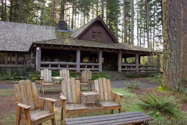
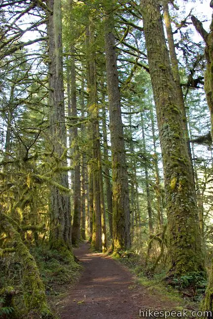
The hike begins from South Falls Trailhead, which is the main trailhead in Silver Falls State Park. The parking area is large, but manages to fill up on weekends. Hike north on Canyon Trail, which is a brick path that goes alongside South Falls Lodge. The Civilian Conservation Corps (CCC) and Works Projects Administration (WPA) built the lodge and completed many other projects, including impressive trail work, between 1935 and 1942 to create the long-standing infrastructure of Silver Falls State Park.
Come to a prominent trail junction called the Stone Circle Junction. You could continue straight to see more of South Falls Historical District and connect to Maple Trail farther ahead, but it is easiest to turn left on Canyon Trail.
You will only get a little bit closer to Upper South Falls before you come to another junction (0.2 miles from the trailhead) where Maple Ridge Trail parts to the right. Leave Canyon Trail for now and turn right onto Maple Ridge Trail to hike the loop in a counter-clockwise direction.
Maple Ridge Trail
Leaving the area in front of South Falls Lodge, Maple Ridge Trail brings you into the forest on the ridge above South Fork Silver Creek. You won’t hike too far before coming to another junction (just 1/8 of a mile from the previous). Stay to the left on Maple Ridge Trail as it passes a trail that goes over to a parking area to the right. This side trail connects to the historical district (if you went straight through the Stone Circle Junction, this is the way to Maple Ridge Trail).
Later on the hike, you’ll be looking up at the tall waterfalls, so why not stretch your neck out a little bit now and look up the tall tree trunks bordering Maple Ridge Trail. The trail weaves through mature hemlocks and Douglas firs, and of course the grand maples for which the trail is named. The forest is lovely (probably especially so in the autumn). The trees grow tall and straight. Their trunks are covered with moss. Tinsel lichens hanging from low branches. The forest canopy provides plenty of shade for even more greenery along the trail, like salmonberry, sword ferns, Salal (Oregon wintergreen), Oregon grapes, and Pacific bleeding hearts. Enjoy a relaxing woodland hike on a wide, dirt single-track trail.
The first half of Maple Ridge Trail is relatively level with rolling terrain. The second half of the trail is a different story, dropping 300 feet down the side of the canyon. When you have hiked 0.55 miles on Maple Ridge Trail (3/4 of a mile from the trailhead), the trail passes a fire road on the right that parts to the east. Ahead, the trail tips downhill toward Canyon Trail.
In another tenth of a mile, the trail curves to the right and becomes steeper. The descent is divided into switchbacks with three sharp turns. Hike a tenth of a mile down to the highest of three switchbacks. They each have a bench for resting weary legs.
From the top bench, it is another 0.35 miles down to Canyon Trail. Take your time and enjoy the views. Rest at any of the three benches if needed. The nice thing about hiking down Maple Ridge Trail instead of hiking up is that you don’t have to climb through these switchbacks (and can save the uphill side of the loop for Canyon Trail and it’s waterfall views).
Weave your way down to a landing at the bottom of Maple Ridge Trail at a junction with Canyon Trail. To the right, Canyon Trail ventures toward the North Fork of Silver Creek and the rest of Trail of Ten Falls Loop. Turn left on Canyon Trail to see the two beautiful waterfalls on South Fork Silver Creek.
Canyon Trail
With 1.3 miles of Maple Ridge Loop complete, begin the next 1.5 miles on Canyon Trail. Although you might expect the descent to be finished, Canyon Trail actually goes downhill for a stretch as it moves away from Maple Ridge Trail. Canyon Trail joins the bank of South Fork Silver Creek alongside a lovely stretch of swift, rolling water. The trail goes gradually uphill now, moving upstream beside the creek.
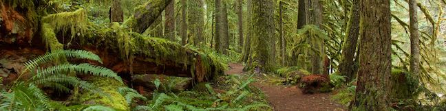
Hike up Canyon Trail through the forest along the creek – a mix of big-leaf maple, Douglas fir, western hemlock, red cedar, vine maple, alders, and cottonwoods. The forest gets about 80 inches of rain annually and is quite lush. The tree branches are covered with moss and lichens. Sword ferns, bleeding hearts, and Oregon grapes flourish along the trail.
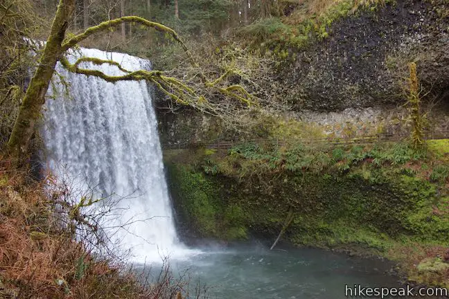
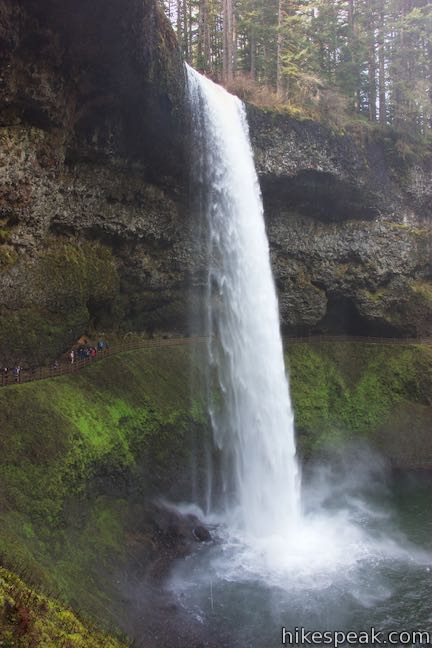
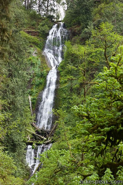
As you approach Lower South Falls, spot Canyon Trail zigzagging up the opposite (southern) side of the canyon. You will get there soon. Ahead of you, Lower South Falls appears, leaping 93 feet from a ledge into the canyon below. The waterfall is a broad white wall flashing down the front of a dark basalt overhang that is splattered by patches of moss and lichens.
You’ve seen the other side of the trail and now you’ve seen the waterfall. What you haven’t seen is a bridge. That’s because Canyon Trail passes right behind the waterfall.
Canyon Trail cuts across the ledge behind Lower South Falls. The thundering water is little more than arm’s length away. Carefully make your way behind the beautiful waterfall. Watch out from slippery stones. If Lower South Falls is gushing, you are likely to get wet.
Coming out from behind the waterfall, the trail crosses the bank on the south side of the creek. For a short distance, the trail goes in a downstream direction, before changing course and climbing toward the creek above the waterfall. As you move away from Lower South Falls, be sure to pause and look down at the picturesque waterfall spilling over the ledge in the middle of the canyon and a U-shaped arc in the trail. The best views of Lower South Falls come from this side of the trail.
Take the zigzagging stone steps up the side of the canyon. Any time you need to catch your breath, just stop for a fresh perspective of Lower South Falls. At the top of the stone staircases, cross a bluff by the top of the waterfall. From here, the trail goes downhill for a short stretch to find the bank of South Fork Silver Creek.
The area of Canyon Trail between Lower South Falls and South Falls explores a lovely stretch of forest that wraps around winding bends in the creek. The trail hugs the creek, so the terrain is gradual and the surroundings are soothing.
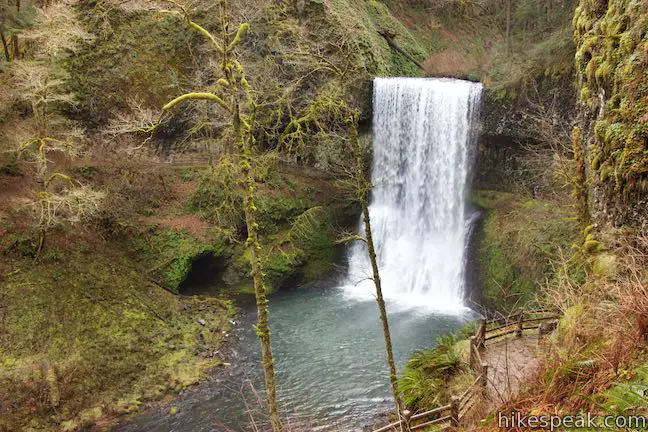
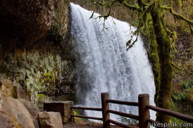
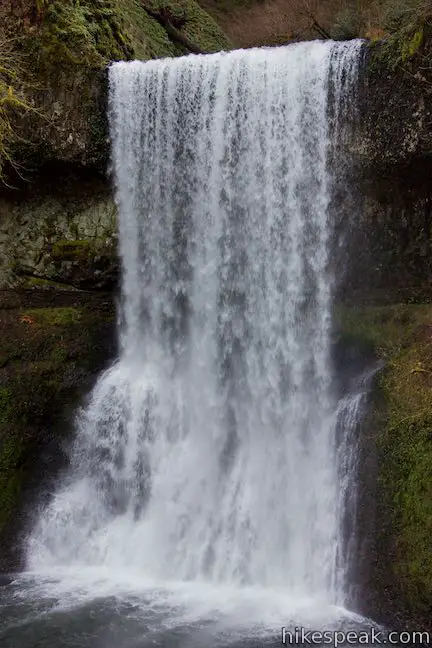
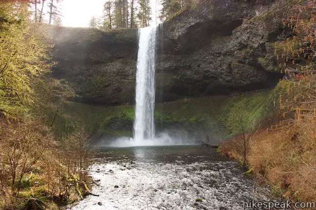
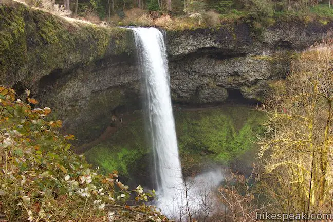
After 2 miles of hiking (and 0.7 miles on Canyon Trail), South Falls finally comes into view. As the waterfall becomes clearer to see, you will realize that South Falls is a beautiful behemoth.
Come to a junction beside a bridge that crosses South Fork Silver Creek downstream from the waterfall. This is a great place to take photos and admire the waterfall. South Falls looks like a white tower. Its water plunges 177 feet from a major basalt overhang in one single, glorious drop.
Canyon Trail splits at the bridge. Straight ahead, the more exciting side of the trail continues up the south side of the canyon leading to a wild section of the trail that crosses ledges behind the waterfall! Across the bridge, the other side of the Canyon Trail goes up a few switchbacks through trees (and more views of South Falls) to reconnect with the branch of the trail crossing behind the waterfall. Taking the straight ahead option, it is 0.6 miles back to the trailhead. The branch to the left, across the bridge, is a tenth of a mile shorter.
If you venture straight, the trail ascends along the bank beside the creek. The landscape has a bit of a bowl shape and the trail is swept by gusts of waterfall winds with water droplets. In front of you – what a view! The dramatic waterfall launches from a basalt overhang and drops and drops (and drops and drops) 177 feet in one big thundering plunge to the canyon bottom.
The trail gets closer and closer to South Falls and somehow finds a usable route across ledges in the cliffs behind the waterfall. Be prepared for spray from the waterfall, which will give you a quick shower as you pass behind South Falls. The trail around the back of the waterfall makes an awesome hiking experience!
Come around to the other side of South Falls, admiring the single-drop waterfall from a different perspective. Reach a junction with the other side of Canyon Trail (coming up from the bridge, bypassing the route behind the waterfall). Turn right to continue ascending toward the South Falls Trailhead.
Hike a short distance up the combined trail to another junction (2.4 miles from the start of the hike). The 200-foot long spur trail to the left leads to a viewpoint for a small cascade named Frenchie Falls. Check out the waterfall and then return to Canyon Trail and continue the ascent.
Back on Canyon Trail, hike up to another junction. Canyon Trail proceeds straight ahead, but you will probably want to stray a bit to the right to South Falls Viewpoint. From this perch alongside the top of South Falls, you can watch the waterfall begin its big drop into the canyon. Look at the South Fork Silver Creek above the waterfall. It seems to flow so peacefully compared to what you know is below!
If you want, you can actually follow a trail from the brink of South Falls that goes along South Fork Silver Creek all the way to the parking area. Otherwise, backtrack to Canyon Trail and continue up the trail. Pass the start of Maple Ridge Trail on the left (you remember Maple Ridge Trail) to get back to the Stone Circle Junction. Turn right and walk over to the parking area.
Dogs and bikes are not allowed on Maple Ridge Loop. Silver Falls State Park charges a fee to park at the trailhead, which is $5 per vehicle for the day or $30 for an annual Oregon State Parks pass. Silver Falls State Park is located in Marion County, Oregon, about 25 miles from Salem. No permit is needed to hike Maple Ridge Loop, so get out and enjoy!
To get to the trailhead: Take Interstate 5 to exit 253 for Route 22 & 99E, following signs for Detroit Lake & Bend. (The exit is about 45 miles south of Portland.) Head east from the end of the offramp on Route 22 (99E). Drive 5 miles and take exit 7, which has a sign for Route 214 and Silver Falls State Park. At the end of the offramp, turn left onto Route 214. Follow Route 214 through several intersections for 16 miles and then turn left, following a sign for South Falls. Now within the park, you’ll make another left to reach the trailhead parking area.
Trailhead address: 20024 Silver Falls Hwy SE, Sublimity, OR 97385
Trailhead coordinates: 44.8776, -122.6556 (44° 52′ 39.4″N 122° 39′ 20.2″W)
The post Maple Ridge Loop
in Silver Falls State Park first appeared on hikespeak.com.

Whalen Island Loop Trail in Clay Myers State Natural Area at Whalen Island 11 Jun 2021 6:07 AM (3 years ago)
What is Whalen Island? It’s not quite an island. It’s not quite on Oregon’s ocean shore. What it is… is a place that is unique, soothing, and beautiful. Wrapped be beaches and shaded by shore pines, Whalen Island sits at the heart of Sand Lake Estuary. Whalen Island – which only becomes an island during seasonal high tides – is just inland from the ocean (close enough to see the waves) on the Tillamook Coast between Cape Lookout and Pacific City. The island is bordered by shallow blue water, mud flats, and marshes – and you can see it all from a 1.5-mile hike around the island’s permitted.
Whalen Island Loop Trail is part of Clay Myers State Natural Area at Whalen Island. The single-track trail is soft and sandy, covering 1.5 miles with 40 feet of elevation change. The terrain is a mix of level and lumpy (there’s not too much to climb on Whalen Island). The west side of the loop follows the island’s forest edge, passing several viewpoints that peer out over beaches and the surrounding undeveloped coastland. The east side of the loop is more forested, with views of the marshes on the opposite side of Whalen Island.
Looking for something shorter? If you prefer to spend more time by the sand, you could convert this hike into a 1.1-mile loop by walking out on the west side of Whalen Island Loop Trail and then walking back on a path across the adjacent beach, skipping the east side of Whalen Island Loop Trail.

Finding the trailhead
When you drive over the bridge onto Whalen Island, the first thing you will pass is a day use parking area on the left that is operated by Tillamook County (changing a $10 day use fee as of 2021). The next thing on the left is Whalen Island County Campground. If you’re only coming to Whalen Island for the day, continue a bit farther to the end of Whalen Island Road, where the road enters Clay Myers State Natural Area. The road makes a loop around a dozen parking spaces, as well as a bathroom. Clay Myers State Natural Area preserves most of Whalen Island, while the county park in one corner boasts nice basic campsites, picnic tables, and a boat launch for kayaks (the estuary is too shallow for motorboats).
Whalen Island Loop Trail connects to the parking area on two sides (it is a loop after all). The directions here follow the loop in a clockwise direction, going out up the west side and back on the east side. This puts you in good positions to gaze out at the coast from the trail, but you could certainly explore the loop in the opposite direction if you wish to see marsh views before ocean views.
Set out from the southwest side of the parking area, opposite from the bathroom. Follow the trail west behind the campground. After a short distance, the trees open up for views over the campground (if you don’t see the campground, you’re on the other side of the loop).
Come to a 4-way junction after a tenth of a mile. Whalen Island Loop Trail makes a slight right turn to approach a trail map. A sharp left turn would put you down a short path to the back of the campground. Ignore this path unless you are staying at the campground. Slightly to the left and across from the path to the campground is another trail that is worth exploring. The short trail travels 75 yards through the trees to the beach at the southwest end of Whalen Island. This broad open area boasts beach grasses and lots of sand to play in. If you walk out toward the water, hoping to take a swim – think again. When you approach the tidal flats, the beach turns into a sandy-mud sort of quicksand that makes it hard to proceed (plus the estuary is really shallow for swimming anyway).
Whalen Island Beach Route
A path traveling north up the beach offers a sandy stroll along the edge of Whalen Island. This is not part of Whalen Island Loop Trail, but you could walk half a mile up the beach, until the sand is pinched by the water, and then pick up Whalen Island Loop Trail and walk 0.55 miles back to the trailhead down the west side of the trail (or take a longer walk on the north and east sides of the island).
Several viewpoints along the west side of Whalen Island Loop Trail have paths connecting to the beach, so the 1.1-mile beach route loop could also be done in shorter distances. For another variation, sections of the beach path could be swapped in to replace portions of Whalen Island Loop Trail. There are plenty of places to explore, especially if you stay overnight at Whalen Island County Campground and take multiple hiking trips.

Whalen Island Loop Trail
To follow through with the primary hiking option in Clay Myers State Natural Area, make your way back to the junction by the map of the island. The map displays several scenic viewpoints along the trail. You will come to the first one almost immediately.
Just past the sign, the trail curves to the right alongside a railing that has views through tall pines out onto the estuary. Look out over the beach and across the gentle waters of the estuary. Across the way is the peninsula of Sitka Sedge State Natural Area, where an eroded sandy bluff is topped by evergreens that have tall bare trunks beneath needle-packed canopies. This is a wild and picturesque piece of the Oregon Coast!
Leaving the first overlook, Whalen Island Loop Trail continues across a dip in the woods. Walk through a tunnel of trees and come down another rise to a split in the trail. A path to the left goes out to the forest edge where there are views over the estuary. The beach below is accessible from here. You’ve only gone a tenth of a mile from the trail junction by the map and already crossed two viewpoints (and this isn’t even one of the six scenic viewpoints along the loop that are highlighted on the map)!
Keep on hiking north on Whalen Island Loop Trail, weaving through a woodland of shore pines. The trees are spaced far enough apart to allow ample sunlight to reach the forest floor. Evergreen huckleberry bushes line the trail, boasting tempting summer berries.
The trail is soft and sandy underfoot. In no time you will come to another scenic viewpoint (this one does make the park trail map). Step off the left side of the trail and walk out to a wooden railing that crosses the top of a sandy ledge at the edge of the forest. Gaze across the sand flats and the estuary pools. To the right, you can spot waves rolling up on the beach at the mouth of the estuary.
This viewpoint is 0.35 miles from the trailhead. In another tenth of a mile, one more path off the trail leads to another vista spot (not highlighted on the map) with improved views of the ocean surf at the end of the estuary.
As you cross the half-mile point of the loop, the trail curves to the right and begins to venture northeast along the north side of the island. A couple paths in this area part from the left side of the trail and pop out from the forest through patches of dune goldenrod to reach the beach. If you brought a picnic, there are nice places to sit and have lunch. This corner of Whalen Island is closest to the ocean. Look out at the mouth of the estuary and the beaches to the north and south.

The views have shifted from the start of the loop, so you can now look across the weaving waterway on the north side of the island. On the opposite shore is a parking area for Sand Lake Recreation Area. (Off highway vehicles may be seen and heard playing on the dunes to the northwest.)
If you wish to circle back to the trailhead along the beach, instead of completing Whalen Island Loop Trail, this is a good place to leave the trail and start walking back on the sand.
After these beach viewpoints (0.55 miles from the start), the trail goes up a hill of sand. Stomp up the trail into the forest above. Follow the trail straight past a couple spur paths on the left and right. Lupines grow in the sunny sand along the trail. Hike down the other side of the hill and around a bend. A path on the left leads out to another viewpoint, located at a wide elbow in Sand Creek. The water is a beautiful blue and close to the trail.
Whalen Island Loop Trail continues into the forest, leaving behind the ocean-facing views. As the trail starts to head south, cross one more important viewpoint. Take the spur down to the left, which leads to a railing at the edge of the Lillian Parker Craft Wetland. In front of you, a plain of green grasses is backed by mountains of dark blue evergreens.
With 0.85 miles completed, the final 0.65 miles are not as eventful as the start of the loop, which is flush with estuary views. Hike along the rolling trail through a mossy forest. Bright pink rhododendrons bloom along the trail in the spring. Salal and ferns are common too, growing beneath Douglas firs and Sitka spruce. At crests in the trail, look for views east over the Lillian Parker Craft Wetland.
Eventually, the trail returns to the parking area in Clay Myers State Natural Area, across from where the loop began. For a bit of extra hiking, just before reaching the road, follow a trail on the left out to an additional view of the wetlands. No permit is needed to hike Whalen Island Loop Trail and parking at the trailhead in Clay Myers State Natural Area at Whalen Island is free (as of 2021), although space is limited. Dogs are welcome on Whalen Island Loop Trail, but bikes are not permitted.
To get to the trailhead: From the center of Tillamook, where US 101 intersects Route 6 (to Portland) and Route 131 (to Oceanside and Cape Meares), travel south on Highway 101. Take US 101 for 11 miles to a major intersection (4 miles past the road to Munson Creek Falls). Turn right onto Sandlake Road and drive west for 4.3 miles. At an intersection with Cape Lookout Road, turn left to stay on Sandlake Road, following signs for Pacific City. (If you are taking the coastal route south down Cape Lookout Road, the Sandlake Road intersection is just 3.3 miles past the Cape Lookout Trailhead.) From the intersection, drive south for 3.6 miles on Sandlake Road and then turn right onto Whalen Island Road. Drive down across a bridge and stay to the right past the county-operated day use area and campground to get to the state-operated parking area at the end of the road, a quarter mile from Sandlake Road.
Coming from the south, from Cape Kiwanda in Pacific City, take Cape Kiwanda Drive north, which becomes McPhillips Drive. After 3/4 of a mile, reach an intersection with Sandlake Road. Turn left and drive north for 3 mile to the turnoff for Whalen Island Road, on the left.
Trailhead address: Clay Myers State Natural Area at Whalen Island, Whalen Island Road, Cloverdale, OR 97112
Trailhead coordinates: 45.2732, -123.9502 (45° 16′ 23.5″N 123° 57′ 00.7″W)
The post Whalen Island Loop Trail
in Clay Myers State Natural Area at Whalen Island first appeared on hikespeak.com.

Munson Creek Falls Trail in Munson Creek Falls State Natural Site 26 May 2021 8:25 PM (3 years ago)
Measuring 319 feet tall, Munson Creek Falls is no tiny trickler. In fact, this is Oregon’s tallest waterfall west of the Willamette River. Munson Creek Falls has picturesque silky tiers framed by canyon greenery. The trek to the waterfall, Munson Creek Falls Trail, is just a quarter mile long (half a mile round trip) with 90 feet of elevation change. The trail explores a lush and lovely old-growth forest on the way to waterfall views. The hike is short and inviting, and getting there is easy too. Munson Creek Falls State Natural Site is located just 8 miles from Tillamook and the trailhead is only a mile and a half off US 101.
Munson Creek Road leaves Highway 101, seven miles south of Tillamook. The pavement turns to gravel and the road narrows. Drive into the forest along Munson Creek and quickly arrive at a parking area at road’s end, where you will find a portable toilet, a picnic site by the creek, and the start of the trail to Munson Creek Falls.
Set out on Munson Creek Falls Trail, which travels southeast up a box canyon alongside Monson Creek. The wide single-track trail is level at the start, but does gain some elevation as it follows the creak uphill to the waterfall. Munson Creek Falls Trail has a few patches that are steeper than you might expect to find on a hike as short as this one. However, the trail is not a workout. It’s a peasant woodland walk. Munson Creek Falls Trail would be tough for wheelchairs, but it is easy enough for young children.
Travel through the old-growth forest of Munson Creek Falls State Natural Site. Western red cedar and sitka spruce rise tall above the trail, providing a shaded canopy. Alders and big-leaf maples thrive beside the creek. As it travels up the canyon, the trail is often right alongside the creek, where terraces of water spilling over rocks. Other times, the creek is only visible through windows between mossy downed logs and clumps of ferns, salmonberry, and elderberry. Spring brings blooming wildflowers like trillium, candy flower, and purple clusters of corydalis.
Pass through a lovely spot where the creek emerges from the forest and tumbles right past the trail, just as the trail launches up a slope. Ascend from there to the hike’s high spot, which delivers the trail’s first and best views of Munson Falls.
Ahead, the trail curves to the right and descends a flight of wooden steps. At the bottom of the steps, Munson Creek Falls Trail crosses a gully and rises to a spot where the trail is barricaded. Unfortunately, the “Trail Closed” sign brings this hike to an abrupt end. Ahead on the trail, there is a large washed out section that makes it unsafe to travel closer to Munson Creek Falls. Reportedly the trail closure is because of a landslide that occurred in the 1990s, which is before Munson Creek Falls State Natural Site became a state park in 2000, so it may be a while before the rest of the trail reopens, if it ever does.
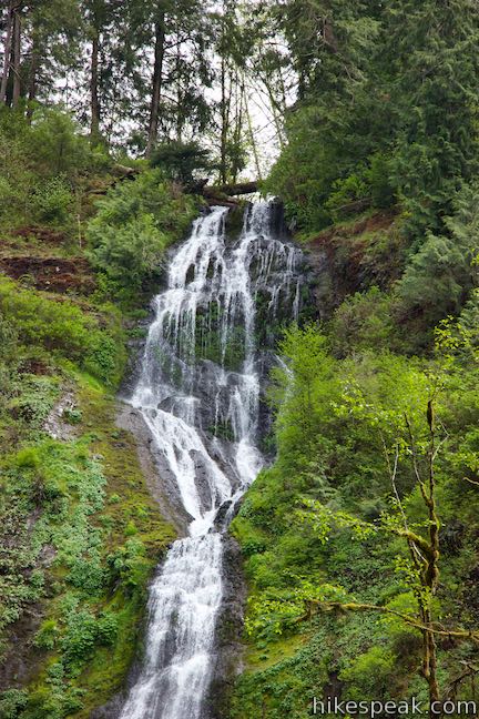
Since you can’t go any farther, stop to enjoy what’s around you. Beside the trail, the creek moves swiftly down the canyon (coursing faster than it did farther below the waterfall). The creek spills over rocks and splashes past mossy logs. Above you, Munson Creek Falls is visible straight ahead through tall brush and trees. The waterfall may be easier to see by backtracking across the gully to the perch at the top of the wooden steps.
Munson Creek Falls emerges from the rim of a forested canyon wall and fans out as is slides over multiple drops. The spilling water strikes a log jam part way down the waterfall as it plunges dramatically into the canyon. Looking like one of the waterfalls you might see in the Columbia River Gorge, Munson Creek Falls is unexpectedly tall for Coastal Oregon. This special beauty is the largest waterfall in the Coast Range.
After absorbing the views of Munson Creek Falls, return the way you came, enjoying a second helping of all the greenery along Munson Creek Falls Trail. The hike is straight forward, with no confusing junctions to worry about. Dogs are welcome but bikes are not allowed. There is no fee to visit Munson Creek Falls State Natural Site and no permit is needed to hike the trail to Munson Creek Falls, so get out and enjoy!
- To see another waterfall in Coastal Oregon, check out Beaver Falls.
To get to the trailhead: From the center of Tillamook, where US 101 intersects Route 6 (to Portland) and Route 131 (to Oceanside and Cape Meares), travel south on Highway 101 for 7 miles. Turn left onto Munson Creek Road (signs for Munson Falls Natural Site). The road becomes unpaved and enters the forest. Follow the signs instructing you to turn left and then right to reach the large turnaround at the trailhead.
Coming from the south, take US 101 north of Lincoln City for 36 miles. Pass the intersection with Sandlake Road (which heads toward Cape Lookout, Whalen Island, and Cape Kiwanda) and drive another 4 miles to Munson Creek Road. Exit the right side of the highway and follow the directions above to the trailhead at road’s end.
Trailhead address: Munson Creek Falls State Natural Site, Munson Creek Road, Tillamook, OR 97141
Trailhead coordinates: 45.36565, -123.77355 (45° 21′ 56.3″N 123° 46′ 24.8″W)
The post Munson Creek Falls Trail
in Munson Creek Falls State Natural Site first appeared on hikespeak.com.

Oceanside Beach to Tunnel Beach in Oceanside Beach State Recreation Site 25 May 2021 8:58 AM (3 years ago)
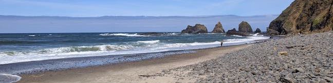
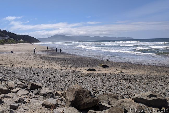
If you find yourself in Oceanside, a small community on the Oregon coast west of Tillamook, you are bound to spend some of the day at Oceanside Beach. This inviting stretch of sand looks out at the wild and lovely islands known as the Three Arch Rocks. Beach goers can enjoy all the usual fun in the sand. Plus, Oceanside Beach State Recreation Site has something unique. A tunnel carved through the cliffs at the north end of the beach lures you in for a fun passage to a second beach that is even more rugged and secluded than Oceanside’s main jewel. The walk from Oceanside Beach to Tunnel Beach is 0.8 miles round trip with minimal elevation change. For more of a leg-stretcher, keep walking and explore the unobstructed coast south of Oceanside.
The adventure begins from the parking area for Oceanside Beach State Recreation Site, located in a tiny coastal town just off the Three Capes Scenic Route to Cape Meares State Park (home of Cape Meares Lighthouse). Walk down to the beach from the parking area. Take a deep breath of ocean air and look out over the waves.
To shuffle toward Oceanside Tunnel, turn right and walk north across the sand. If you stray to the left, you’ll be walking toward Netarts Bay. The beach is wide open in that direction, with nothing to block your path that would require a tunnel.
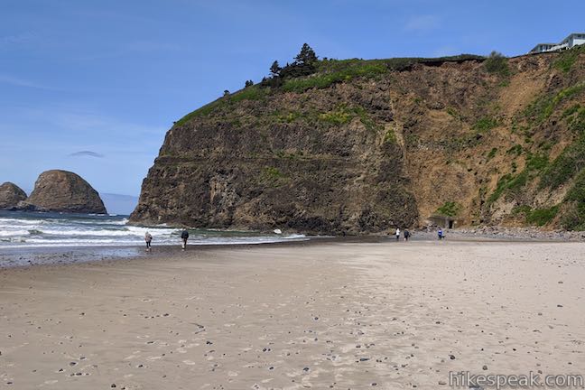
Walk north up Oceanside Beach toward Maxwell Point, where cliffs form a wall at the north end of the beach. At the base of the cliffs at the back of the beach, look for an out-of-place tunnel entrance and head toward it.
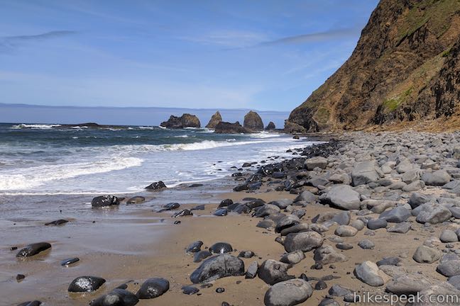
As you travel up the beach, enjoy views of the Three Arch Rocks, a cluster of rock islands with natural tunnels carved through them by the waves. This wild and beautiful offshore formation is a protected national wildlife refuge where sea lions raise their pups and sea birds nest.
After less than a quarter mile of beach walking, come to the mouth of the man-made tunnel carved into the cliffs. A fallen rock warning sign is posted next to the tunnel entrance. Looking up the adjacent cliffs, the risk of a rock fall is clear. Be cautious and move quickly.
The start of the tunnel is a molded concrete corridor with small round windows cut into the ocean side that let in light and allow you to peak back out at the beach. Venture deeper into the tunnel where the well-formed concrete structure is replaced by rough rocky walls and a lumpy floor. The tunnel is only about 125 feet long from end to end, so light from the tunnel exit is visible almost immediately. Watch your step as you proceed over the uneven floor. Light your path with the a flashlight or a headlamp if you brought one (a smartphone flashlight is sufficient).
As you clamber over the rocks, you might be asking yourself – what’s the story behind this tunnel? What’s the history? Why is it here? While building the first vacation resort in Oceanside, the Rosenberg family carved out the tunnel to create greater beach access for guests. In 1968, according to Oceanside Beach State Recreation Site’s official webpage, Orin and Lorraine Rosenburg gifted the first parcel of land that became the public beach park, which included Maxwell Point and the beach access tunnel.
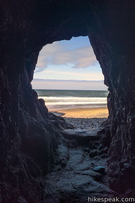
Framed by the oval opening at the end of the cave, a secret beach appears! Make your way out of the north end of the tunnel. In front of you is a postcard-worthy piece of the Oregon coast. Tunnel Beach is a cobblestone beach that is about 300 yards long, framed by Maxwell Point to the south and another barrier at the far end made up of a string pointed rocks.
With fewer visitors than Oceanside Beach, Tunnel Beach looks much more rugged. It feels like oceanfront that has barely been touched by humans (ignoring, of course, the tunnel you just came through). Tunnel Beach boasts an excellent perspective of the Three Arch Rocks, as this is about as close as you can get to those islands without leaving the shore.
Walk up Tunnel Beach as far as you like.
It is probably safest not to go past the stroll-able section of the beach by attempting to forge through the rocks and surf beyond. At low tide and with wet feet, it may be feasible to reach a small beach on the other side of the rocks north of Tunnel Beach. Rip tides are present, so it is safest not to attempt traveling past Tunnel Beach. Instead, turn around and walk back down Tunnel Beach. The scenery is wonderful. What more could you want?
When you come back to Maxwell Point, just like at Oceanside Beach on the other side, the tall cliffs extend out into the ocean and prevent any further walking on the sand. Veer inland to the easy-to-spot mouth of the tunnel. Climb inside and make your way through. Pop out the tunnel’s other end onto Oceanside Beach and stroll back to the day use parking area (or press on and walk farther south down the beach).
No fee is required to visit Oceanside Beach State Recreation Site and no permit is needed to walk to Tunnel Beach. Bathrooms are available at the trailhead and leashed dogs are welcome. Sandcastles are encouraged. Enjoy your time at the beach!
To get to Oceanside Beach State Recreation Site: From the intersection of Highway 101 and Route 6 in Tillamook, head west on Netarts Highway (Route 131), which is straight across Highway 101 from Route 6 for those traveling from Portland. Take Route 131 southwest for 5 miles and pass Whiskey Creek Road, the route to Cape Lookout. Drive another 3.8 miles on Netarts Oceanside Highway (Route 131), traveling northwest up the coast. Reach an intersection at the edge of Oceanside and turn left to stay on Route 131 following signs for Oceanside. (The road to Cape Meares is to the right.) Drive another quarter mile, come to a stop sign, and turn left down the road into the parking area for Oceanside Beach State Recreation Site. The path down to the sand begins at the south end of the parking area.
Trailhead address: Oceanside Beach State Recreation Site, Rosenberg Loop, Tillamook, OR 97141
Trailhead coordinates: 45.4605, -123.9700 (45° 27′ 37.8″N 123° 58′ 12″W)
The post Oceanside Beach to Tunnel Beach
in Oceanside Beach State Recreation Site first appeared on hikespeak.com.

Old Salmon River Trail in Mount Hood National Forest 10 Aug 2020 6:58 AM (4 years ago)
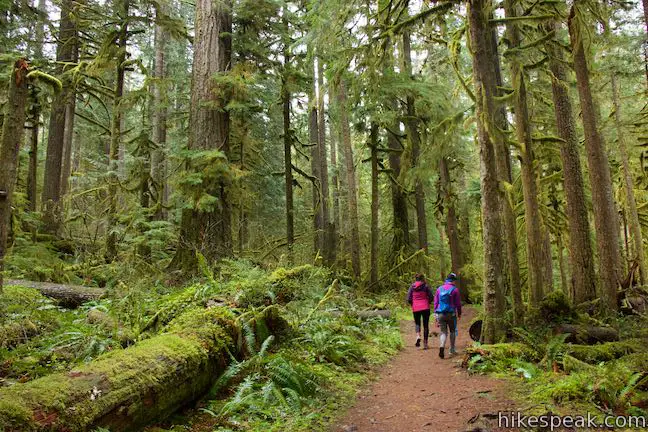
After just one bend on Old Salmon River Trail, you will already feel deep within the old-growth forest that surrounds the Salmon River as it flowing through Mount Hood National Forest. This Pacific Northwest woodland feels timeless, or perhaps from another time altogether, with its tall, century-old Douglas firs absolutely covered in green moss.
Old Salmon River Trail is 2.55 miles long between two trailheads on Salmon River Road, taking a mostly level course along the river with 175 feet of elevation change.
How far is this hike? You decide. The whole outing is 5.1 miles round trip. Near the southern end, the trail crosses Green Canyon Campground, which has a picnic area and a bathroom. Use the campground as a turnaround point creates a 4.35-mile round trip hike. Shorter outings are also possible. The trail borders the road for a short stretch near the middle and numerous paths connect to the trail from turnouts along Salmon River Road. There are multiple places to start or stop a hike on Old Salmon River Trail. Car shuttles can be arranged with two vehicles.
The directions offered here set out from the official trailhead at the north end of Old Salmon River Trail. This is the first trailhead along Salmon River Road when driving in from Welches, Oregon along Highway 26. Beyond Green Canyon Campground, the trail extends to Salmon River Bridge, where Salmon River Road crosses the flow.
Looking at a map of this trail, you might be discouraged to see that it hugs close to the road most of the time. Don’t be. Despite the proximity, you won’t see or hear traffic out on the trail. The density of the forest, the slope down from the road, and the soothing sound of the river all help to make Salmon River Road disappear.
The basic directions for Old Salmon River Trail are:
- Set out from Old Salmon River Trailhead (0 miles)
- Cross the first footbridge as the Salmon River comes into view (0.1 miles)
- Ascend stairs to the left of a small clearing along the riverbank (0.5 miles)
- Cross two bridges over streams that flow down to the Salmon River (0.7 miles)
- Explore a short path on the right leading to an access point along the Salmon River (0.75 miles)
- Rock hop across a seasonal stream (1.1 miles)
- Pass paths out to an island in the river flow (1.3 miles)
- Begin bordering Salmon River Road across from the Salmon River Slab climbing area (1.4 miles)
- Part from the west side of the road as the trail goes back into the forest (1.5 miles)
- Cross one more footbridge (1.9 miles)
- Pass the edge of Green Canyon Campground (2 miles)
- Come to a path on the left to a picnic area by the campground (2.15 miles)
- Turn here to visit the picnic area and then hike back, using Green Canyon Campground as the south end of the hike (4.35 miles round trip)
- Breeze past the picnic area and continue another 0.3 miles to Salmon River West Trailhead at the Salmon River Bridge (5.1 miles round trip)
Start from Old Salmon River Trailhead, which is 2.7 miles up Salmon River Road from Highway 26 in Welches, about 17 miles past Sandy on the drive from Portland to Government Camp.
Hike down to a picnic table where the trail bends to the left and angles southwest toward the river, becoming absorbed by a damp and verdant woods where the tree trunks and branches are covered in mossy growth. The sides of the trail are blanketed in the green of sword ferns and oxalis (wood sorrel).
A national forest sign by the picnic table highlights some of the features of this special forest:
You are standing in a rare forest – but one much like those that once dominated the Pacific Northwest. It’s an old-growth forest, where some of the trees are more than 150 years in age. In addition to these grand trees, old-growth forests have lots of dead wood, many layers in the canopy, and a colorful medley of plant and animal life.
This old forest is a fortunate place to be. The sign explains that climate change is pushing old-growth forests to their limits, making it harder for them to survive. As climate change worsens, old-growth forests become even more important. The forests’ cool shade creates vital refuges for animals. The abundant plant life removes CO2 from the atmosphere to help curb climate change. Conserving of old-growth forests is part of the mission of the US Forest Service.
Proceed down the trail across an early footbridge. Look to the left to see a small stream flowing down a depression in the forest. The trail gains greater and greater views of the Salmon River, which slides over short rapids as it passes through the forest.
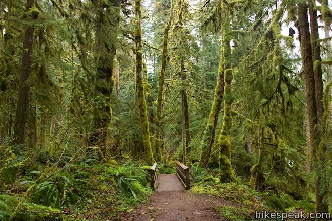
Mighty Douglas firs, western red cedars, and western hemlock rise high above Old Salmon River Trail. In the spring and summer, keep an eye on the forest floor for flowers with three white pedals – the cheerful blooms of trillium.
Pieces of old trees are strewn around the ground. Great fallen tree trunks and stumps give new life to the forest. Take a close look as the trail passes several stumps that host fascinating miniature forests of saplings, moss, and ferns. The forest service sign by the trailhead has a term for this new growth from old trees – old growth nurse logs.
Fallen and decaying logs are one of the structural elements of an old-growth forest. They provide homes for insects, amphibians, and small mammals. Fungi thrive in this habitat. As the log decays, it becomes a “nurse” to young trees.
Make your way down to the edge of the Salmon River where bigleaf maple, vine maple, and alders thrive along the riverbank. Cross a small stream and begin moving up a flatter and more open area alongside the river. This is a great spot to climb up on logs and find views of the river as it flows by.

The trail proceeds to the left toward a flight of wooden steps. Ascend these stairs, half a mile from the trailhead to come to a hollowed-out tree. Step inside the tree if you are a child or a child at heart. The trail curves to the right and heads south again along a bank above the Salmon River.
Old Salmon River Trail squeezes across a steep bank above the river crossing a pair of bridges. The first bridge, 2/3 of a mile from the trailhead, spans a cascading stream that springs from a pipe that takes the water underneath Salmon River Road. After the second bridge, the steep terrain transitions back to the more tapered forest that appeared along the start of the trail, providing a lovely woodland passage.
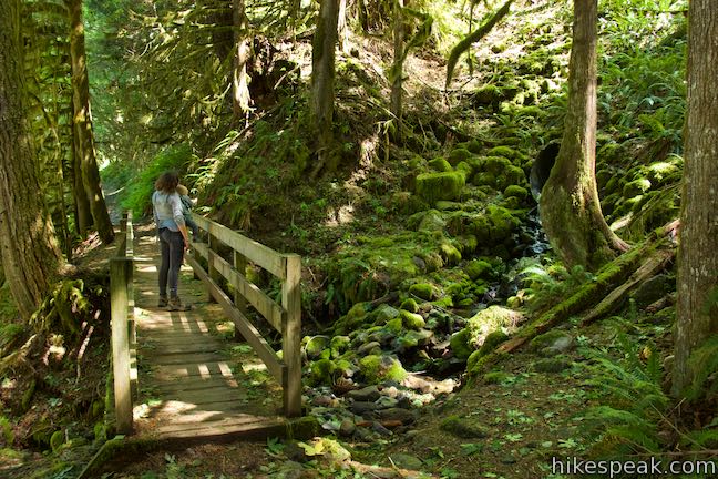
Just past the bridges, come to a short path on the right that descends to a nice spot on the shore of Salmon River. The water is fairly calm in front of this beach-like area, making it a tranquil place to take a break and have a snack.
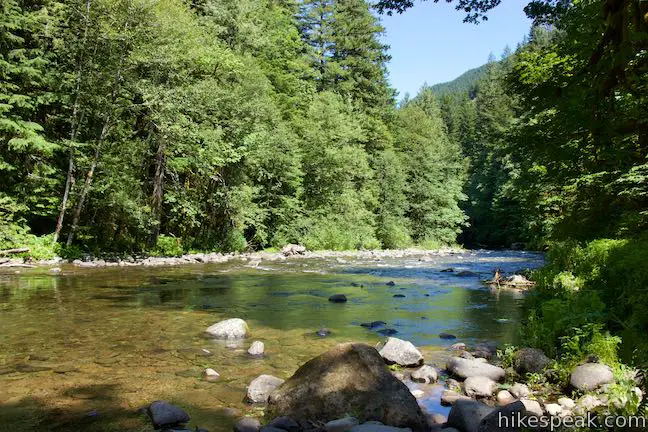
Continue up the trail to a spot, 1.1 miles from the trailhead, that will either be memorable or forgettable. During much of the year, you can simply walk across a wide dry creek bed. A line of rocks create a rock-hopping path if some water is present. At the peak of the rainy season, you’ll need to “ford the river or caulk the wagon” – or at least be prepared to get your feet wet.
At around 1 1/4 miles from the trailhead, pass the first of a couple paths venturing out to the right that go across a mostly dry river channel out to a forest island along the river. The next stretch of trail gets decorated by the tall purple blooms of foxgloves.
At 1.4 miles from the start, Old Salmon River Trail exits the trees and meets Salmon River Road. This isn’t the end of the trail, so don’t turn back! Instead, walk a tenth of a mile along the right side of the road. To your right, look for anglers along the riverbank casting for fish. A rock face rising to the left, on the other side of the road, is a popular rock climbing spot called Salmon River Slab.
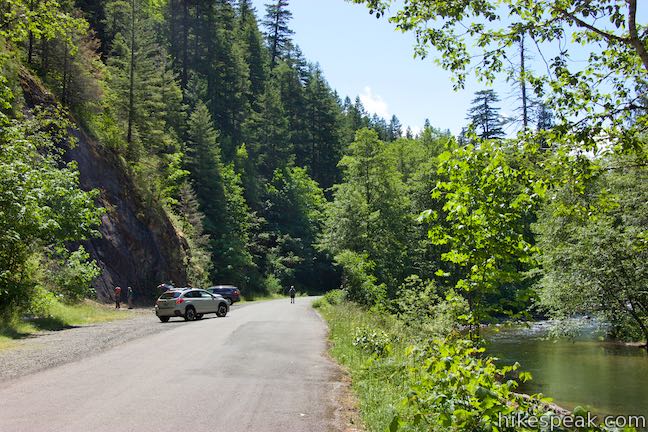
Head back into the forest where the trail resumes, marked by a sign reading, “Old Salmon River Trail 742A.” Leave the new road for old growth and make your way through more gorgeous trees. The trail passes rocky beaches along the river. As you enjoy the river views, spot salmonberry and thimbleberry bushes blossoming in sunny patches along the bank.
A tenth of a mile past one more little footbridge, and 2 miles from the trailhead, come to the edge of Green Canyon Campground. Campsite 9 (of 15) borders the trail just across from a gleaming stretch of the Salmon River. Anyone staying at the campground can walk right out of their campsite and onto Old Salmon River Trail.
Proceed down the trail, which plots a course across the top of the riverbank behind the campsites. After another 0.15 miles, a not-so-easy-to-spot path branches off to the left.
If you take this path…
The path meanders through some trees to a picnic site by the entrance of Green Canyon Campground. This day-use area makes a decent turnaround point or alternative starting point. A few parking spaces are available for the day use area. A road through the campground serves as another route back to the trail beside campsite 9. Make your way back to the trailhead at the north end of Old Salmon River Trail for a 4.35-mile round trip hike.
If you skip the path…
The trail proceeds another 0.3 miles around a few bends in the Salmon River. The trail comes to an end as you reach Salmon River West Trailhead where Salmon River Road crosses the Salmon River. Across the road, Salmon River Trail (not to be confused with Old Salmon River Trail) ventures 14 miles up into the Salmon-Huckleberry Wilderness Area. Parking spaces for about ten vehicles are available here for people attempting that longer hike or arranging a shuttle on Old Salmon River Trail. Unless you’re prepared to keep going, turn around and hike back down the river the way you came for a 5.1-mile round trip hike.
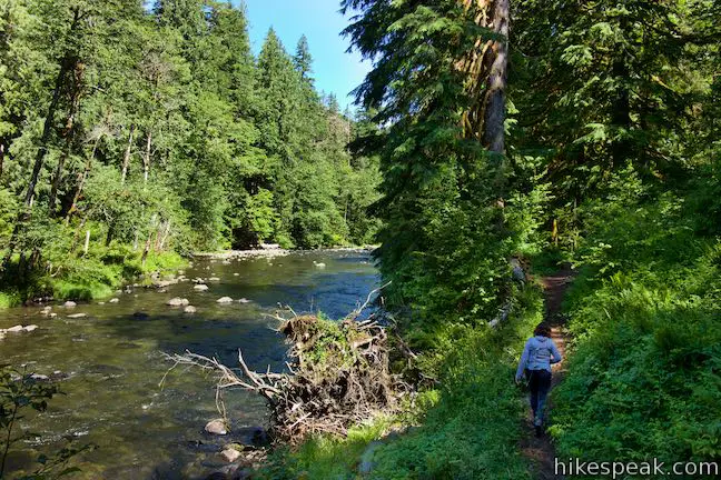
Note: Mount Hood National Forest maps consider Green Canyon Campground the be the official end of Old Salmon River Trail. The southern extension of the trail between the campground and Salmon River West Trailhead is technically the first part of Salmon River Trail and not the last part of Old Salmon River Trail. However, if you want to hike all the way up the river to the bridge (possibly setting up a car shuttle), it’s easiest to treat these 0.55 miles as a natural extension of Old Salmon River Trail.
Dogs are allowed on Old Salmon River Trail as are mountain bikes (although the trail doesn’t seem popular with bikes). Old Salmon River Trail is within the Zigzag District of Mount Hood National Forest and a Northwest Forest Pass is required to park at the trailheads.
To get to the trailhead: From the west, take Highway 26 to Sandy. Drive another 17 miles up Highway 26 (Mount Hood Highway) to the small community of Welches. Turn right onto Salmon River Road, which comes 1/4 mile before the Zigzag Ranger Station. Drive 2.7 miles up Salmon River Road to Old Salmon River Trailhead, which is the first trailhead on the right.
If you wish to drive farther up Salmon River Road, it is 1.3 miles to Salmon River Slab, 1.9 miles to Green Canyon Campground, or 2.3 miles to Salmon River West Trailhead.
Trailhead address: Old Salmon River Trailhead, Salmon River Road, Welches, OR 97067
Trailhead coordinates: 45.3085, -121.9432 (45° 18′ 30.6″N 121° 56′ 35.5″W)
The post Old Salmon River Trail
in Mount Hood National Forest first appeared on hikespeak.com.
